Sowats to 150-Mile via Scotty's

October 27 to November 2, 1998


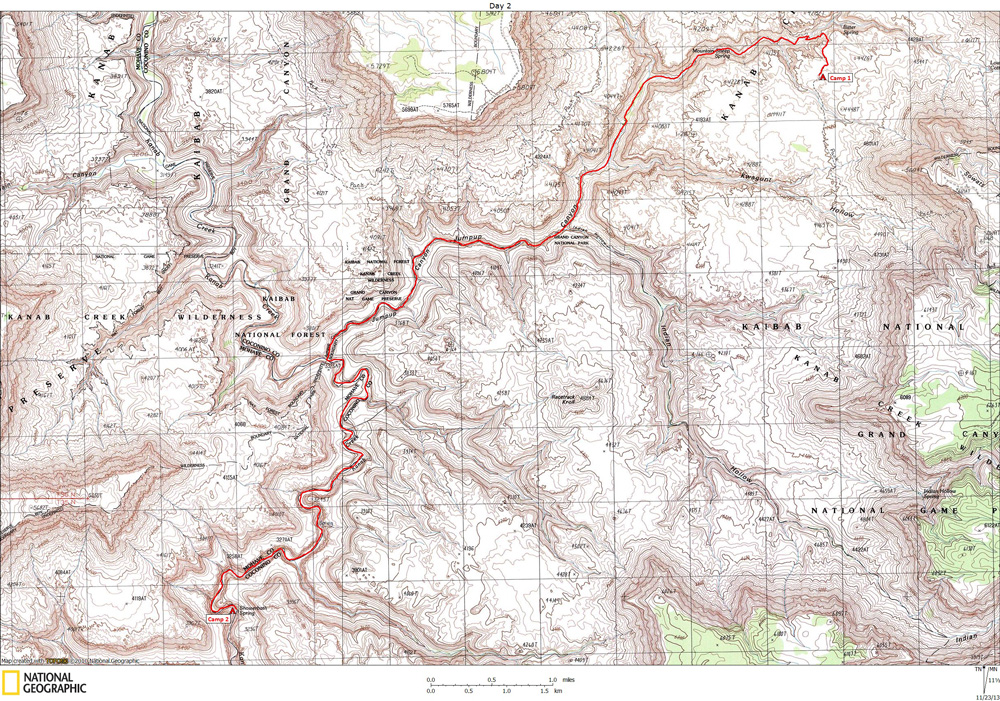
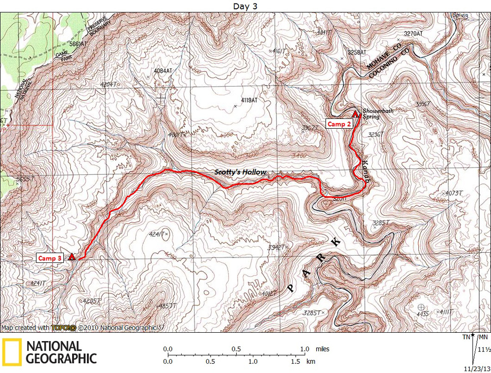
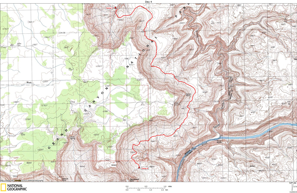
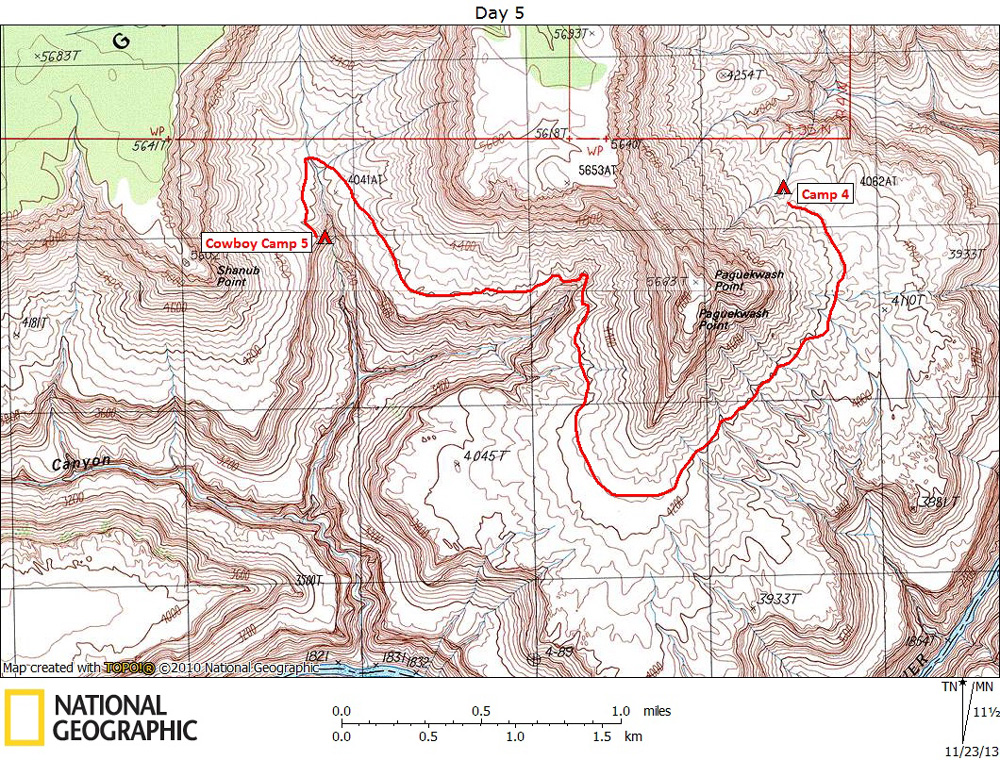
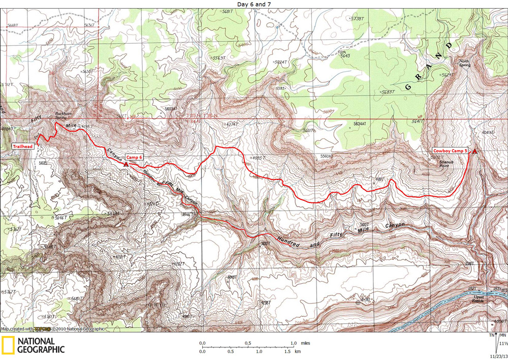
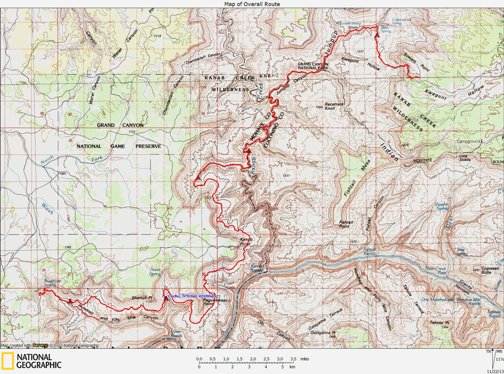
Preface:  This backpacking trip started at Sowats Point, the beginning of the Jumpup-Nail Trail, and ended seven days later at the 150-Mile Canyon Trailhead.  The above map shows our overall route.

Much of this route is described by George Steck in Grand Canyon Loop Hikes II

There were seven of us on this trip.  Unfortunately I can't locate any of the photos I took. 


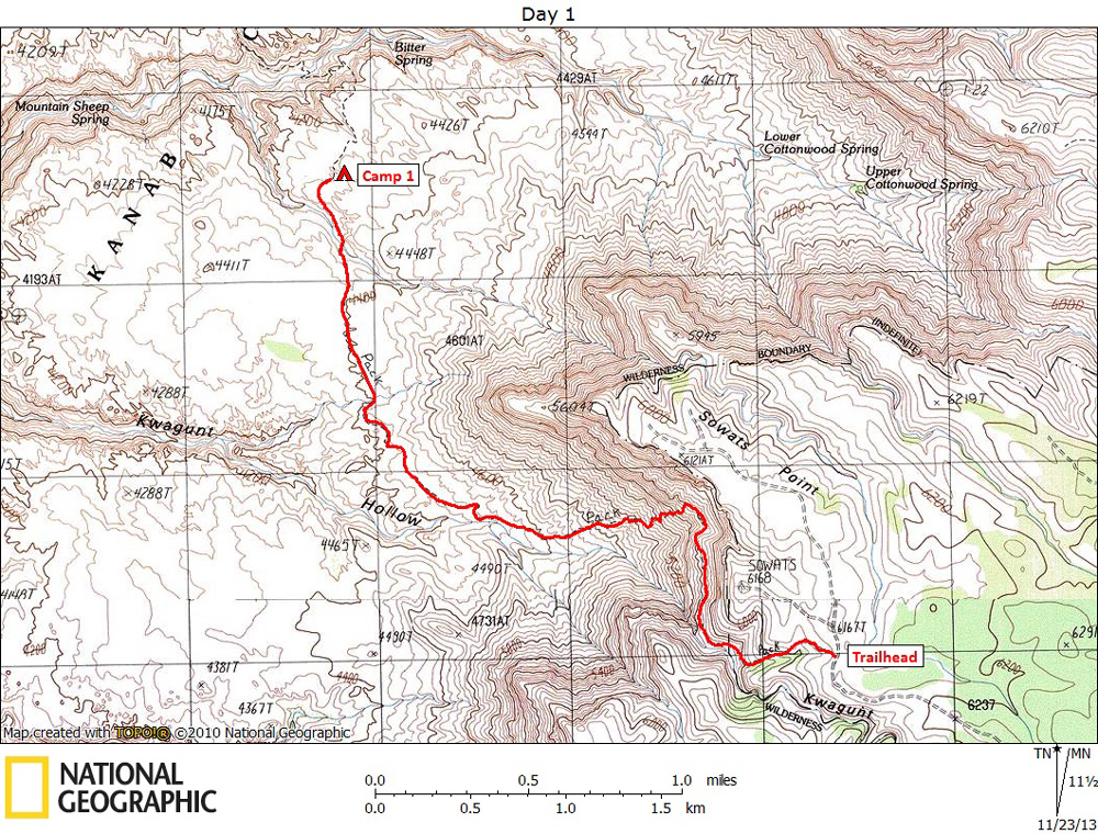
Day 1 - October 27:  The following map shows our route on day 1.

After spending the night in Kanab, the seven of us were shuttled out to the Sowats trailhead, and the start of the Jumpup-Nail trail.  We didn't get there until mid-morning.  The trail is well constructed and well marked.  It begins by heading down into a fairly  shallow drainage in the Kaibab limestone, then, just above a huge pouroff, the trail turns north, staying at a pretty constant elevation, until reaching a talus slope that extends all the way from the Esplanade to the Toroweap.   It took a little over an hour to get down to the Esplanade.  It had rained the night before and potholes were full.  We were originally planning to hike all the way to Mountain Sheep Spring, but because of the abundance of water, we decided to stop on the Esplanade close to where the trail drops into Sowats Canyon.  We had covered only about 3.5 miles.


Day 2 - October 28:  The following map shows our route on day 2.

This morning we descended the 400 feet to the bottom of Sowats Canyon.  Although the trail continues up the other side of Sowats and back to the Esplanade, we turned down Sowats Canyon, hiking past Mountain Sheep Spring and on to Jumpup Canyon.  We hiked through the spectacular Jumpup narrows to Kanab Creek.  We then turned down Kanab Creek.  Kanab was knee-deep and flowing swiftly, with deeper holes hidden beneath the muddy water.  It was slow going.  We stopped for the night at Showerbath Spring.   It was a long day, about 11 miles. 


Day 3 - October 29:  The following map shows our route on day 3.

We got an early start and reached the mouth of Scotty's Hollow in about 45 minutes.  Although I wasn't following Steck's route description at the time, after reading it again I think his description jibes well with my memory, except perhaps for the upper end of Scotty's.  There were numerous small challenges all the way up, and several places where we had to carry packs across 3 to 4-ft deep pools.  I remember one very large pool where we had to swim.  After crossing the pool, we climbed up to a ledge that went back to a point where we could haul packs up using some webbing, thus avoiding crossing he pool with our packs.  There were at least two places where some people wanted a belay.  We camped near some shallow caves not far below the Esplanade, just above a large pouroff that required some cautious climbing on the creek-right.  The cave on creek-right is about is about 50 feet above the canyon floor and has a spectacular petroglyph panel.  There were only a few small potholes in the canyon floor.


Day 4 - October 30:  The following map shows our route on day 4.

This morning we climbed out of Scotty's on the left, next to the petroglyph cave.  I don't remember any serious obstacles, and I never saw Steck's mushroom rock, but I wasn't looking for it.  I can't remember exactly, but I think it took us less than an hour to get to the Esplanade.  Once on the Esplanade the hiking was fast and easy.  We stopped for the night near potholes NE of Paguekwash Point, after hiking about 9 miles.  This is close to Jewel Spring, but we never looked for it.  Between Scotty's and 150-Mile there were no technical difficulties.


Day 5 - October 31:  The following map shows our route on day 5.

Today's hiking was short and uneventful, but beautiful.  We had perfect weather, cool and partly cloudy.  Route finding is easy if you consult your map and keep track of the main points on the rim below which you pass.  I had a GPS which was an interesting diversion, but not extremely useful.  We hiked around Paguekwash Point and past the NE arm of 150-Mile Canyon.  After heading the north arm, we found an old cowboy camp hidden in the Supai just below the rim.  This was not one of the cowboy camps mentioned by Steck.  It consisted of a large cave with lots of old cowboy stuff laying around.  There were also several large potholes nearby.  I think a couple of us camped inside the cave, but I camped on the slickrock nearby. 


Day 6 and 7 - November 1 and 3:  The following map shows our route for the next two days.

Day 6 was a very short backpacking day.  We camped at the head of 150-Mile Canyon.  Some of us spent the afternoon on a pleasant hike down 150-Mile Canyon.  We reached the top of the Redwall before turning around.  We we encountered no obstacles. 

Our last day was the shortest.  A brief hike up 150-Mile brought us to Buckhorn Spring and the start of the trail to the rim.  We were at the top by mid-morning.  Our ride was waiting for us.

A note of caution:  This Esplanade route was relatively easy for us because the temperature was cool and the recent rains had filled the shallow potholes.