|
Backpack around Powell Plateau with George Steck
NOTE: Click on Hypertext to view photos.
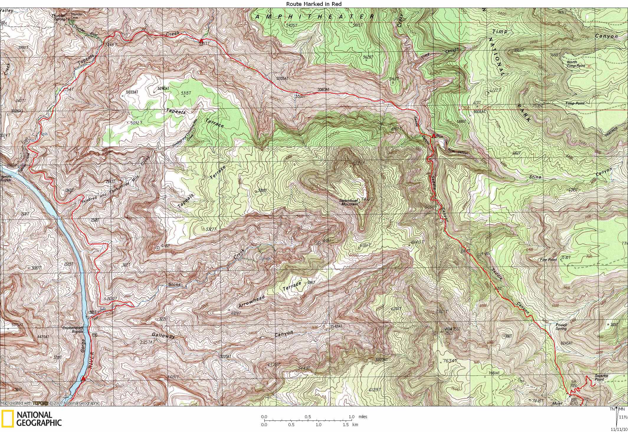
Four maps show the route: Preface. A description of this route is described by George Steck in Grand Canyon Loop Hikes I. This was a Sierra Club trip, scheduled for 12 days with no layover days. The extra days (book says 9 days required) were to be spent in Modred and Merlin Abysses. Bert Fingerhut was originally one of the trip co-leaders, but he had to cancel and Gary Ladd took his place. I had done one of Steck’s loops the previous year, but this was my first Sierra Club trip. I really wanted to meet and hike with George Steck.
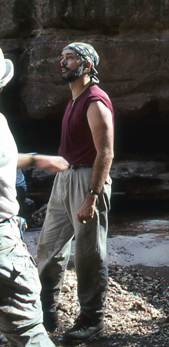
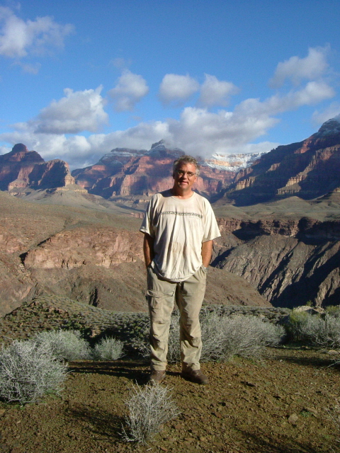
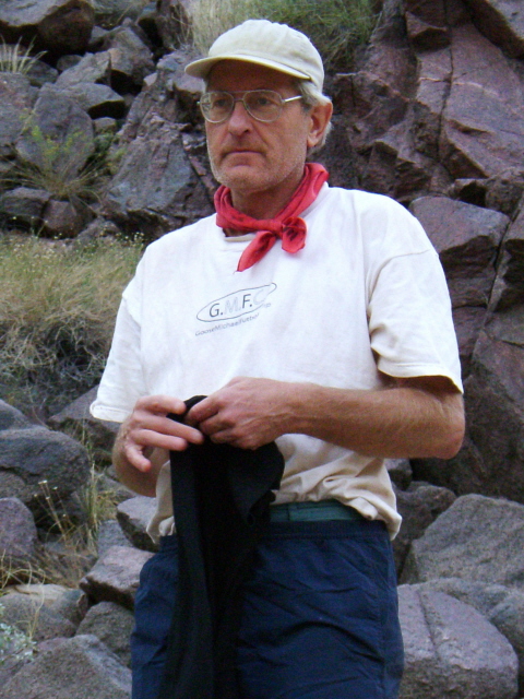
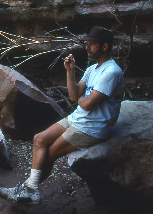
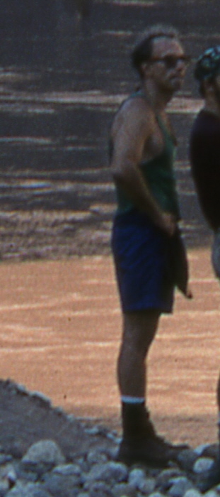
Trip members included
Mike Arant,
Bob Bordasch (Boulder, CO),
Jarold Buell (Houstin, TX),
Jim Cummer,
Jim Ilchuk (Oakland, CA),
Gary Ladd (Page, AZ),
Stan Mogelson (Twin Falls, ID),
Doug Nering (Phoenix, AZ),
Marcey Olajos (Tucson, AZ), and
George Steck (Albuquerque, NM).
Gary Ladd was the Trip Leader.
September 22.
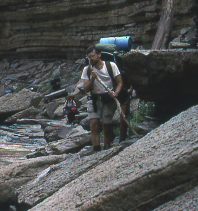
I got an early start driving to the Canyon from Salina, Utah where I had spent the night after having driven there from Boulder the previous afternoon. I got to the North Rim Ranger Station about noon where I met up with the other trip members. After introducing ourselves and drinking a few beers, we followed Steck on the long and sometimes rough dirt road to the North Bass trailhead at Swamp Point.
Communal gear and food was divided up among the participants. Marcey cooked dinner and explained the rules of the trip. Four cooking groups of two people were assigned. My cooking partner was Stan. Our first day would be day three, then every fourth day after that. A group’s cooking day started by cleaning up breakfast on your assigned day. This was followed by making lunch, dinner (and dinner cleanup), and finally by making breakfast the next day (no cleanup). Splitting up the breakfast chores was a big help in getting an early start in the mornings.
It began to cloud up just before sundown and we all set up tents (except Steck who slept in his VW bus). It rained off and on all night.
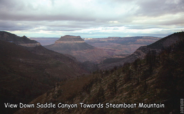
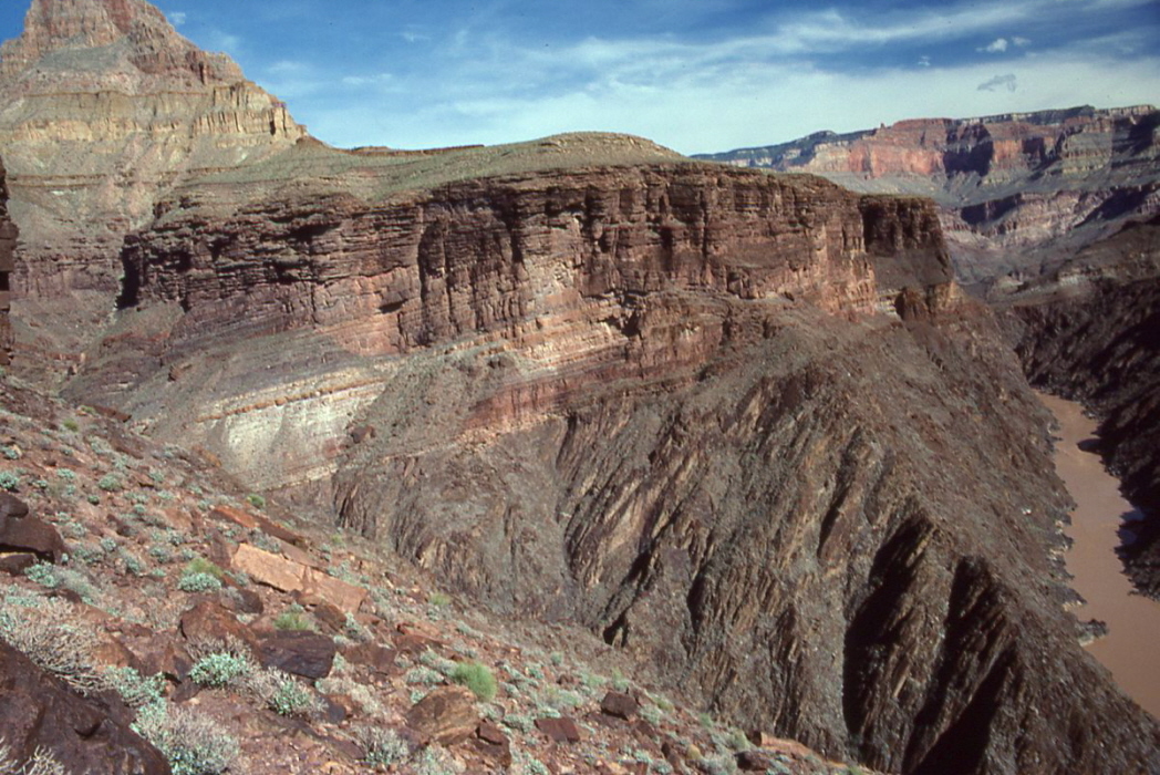
September 23. Got up early and had breakfast before sunrise (as would be typical for the entire trip). Because of the rain, I decided to take my tent rather than just a tarp (an extra two pounds). A light rain began about half way down from Swamp Point to Muav Saddle. When we got to the old cabin at the saddle, we rested and put on rain gear. Now would begin the hard part. We turned off the North Bass trail and went down the Saddle Canyon drainage to the NW. We fought brush, trees, and other vegetation for about an hour. After passing the side drainage to Powell Spring, the canyon bottom opened up a little and we could walk down the almost dry creek bed without having to deal with too much brush. The sky began to clear. Soon we left the drainage and followed a low ridge on the left to bypass pouroffs in the Supai. Although steep and loose in places, it all seemed a little easier than I had expected.
We soon found ourselves in the canyon bottom at the
top of the Redwall.
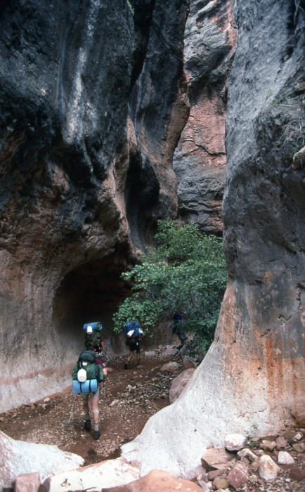
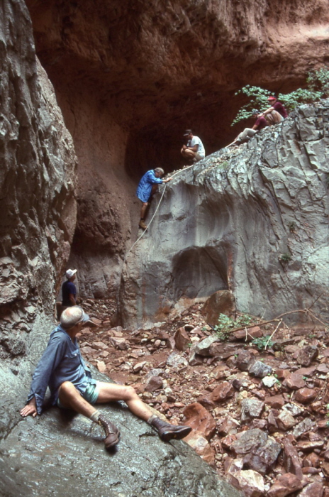
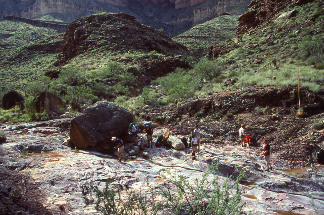
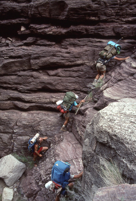
Before long we came to our first major obstacle, a 15-ft drop requiring the use of a handline. As we entered the
Redwall,
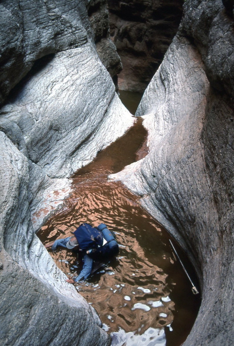
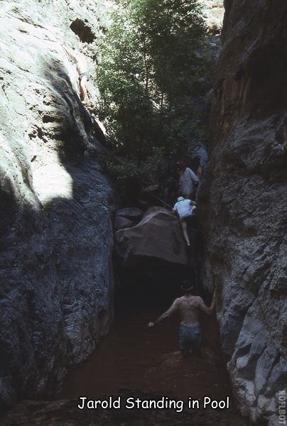
the canyon abruptly narrowed and became much more sinuous. Water had scoured the limestone into smooth and slippery chutes, often interspersed with
deep pools of muddy water.
Soon we were lowering packs down these and slides. There were more and deeper
pools than usual because of the recent rains. In several places we had to hand packs down to someone
standing in the pool below, and he would carry it across. Some of the pools were over our heads in places. Somewhere near the top of these narrows we had
lunch.
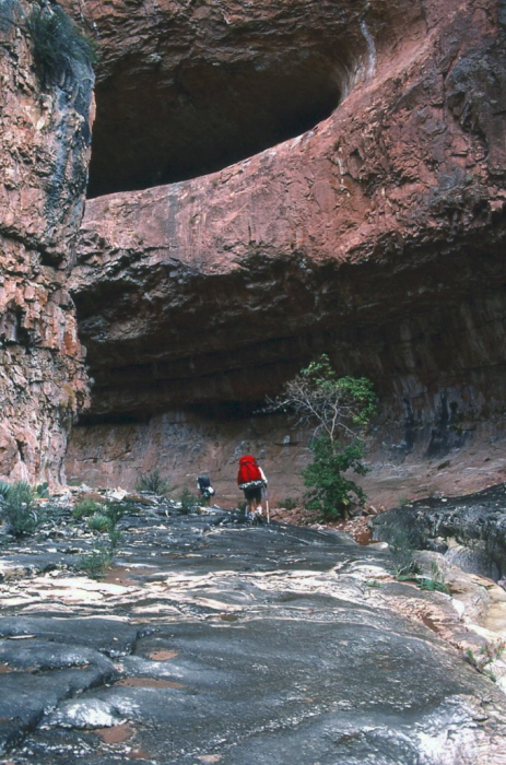
At the bottom of the Redwall the canyon opened up and we came to a very large dryfall. A narrow ledge and a talus slope on the left made our continuation possible. About 30 minutes after bypassing the dryfall, we reached the mouth of Stina, our destination for the day.
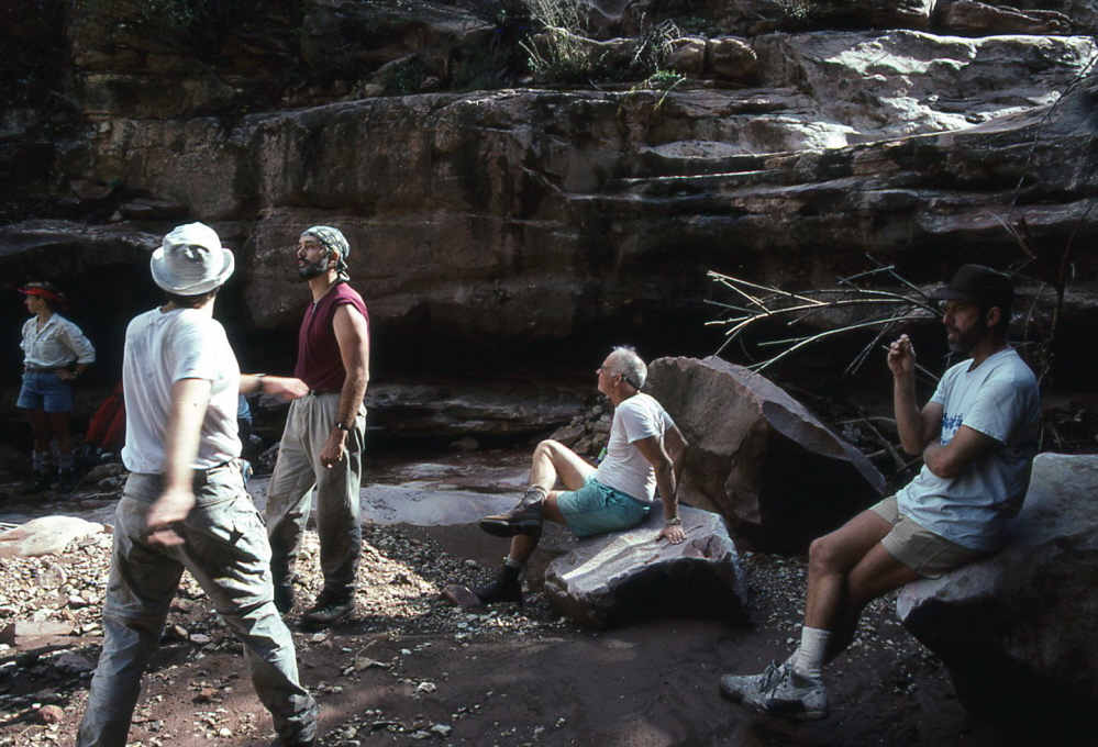
Campsites at the Stina/Saddle junction were scarce. By the time each of us had selected a spot for the night, we were scattered over about 200-300 yards of canyon bottom. We were all pretty exhausted and went to bed soon after dark. Rain was still threatening, so I set up my tent. I was about 30 feet from the nearly dry creek bed and several feet above it.
Soon after getting settled in my tent it began to lightly rain. I heard thunder in the distance. During the next hour the rain steadily increased as the lightening moved closer. By 20:00 (about two hours after sunset) there was a moderately heavy rain and the lightening seemed to be directly overhead. Although I thought I had selected a reasonably safe spot for my tent, I began to worry about flooding. I started listening to the sound of the creek, trying to hear any increase in intensity. I could tell that more water was in the creek than was there a few hours before, but it didn’t sound like flooding. The deafening sound of the thunder echoing in the canyon, combined with the sound of the rain on the tent and the wind, made it difficult to differentiate creek sounds from others. But by 20:15 the sound had grown into a small roar and I really began to worry. I got my flashlight and poked my head out of the tent to look for water. It was extremely dark (deep canyon, clouds, no moon). Within a few minutes the sound of the creek dramatically intensified. I now believe that was the moment when the flood waters began pouring over the waterfall several hundred yards up-canyon. During the few minutes I had my head out of the tent, the sounds continually increased until the ground started to vibrate. I heard rocks rolling down the creek. Someone (Mike?) started yelling WATER! I jumped out of my tent and ran to the creek for a look. The water had risen several feet and the velocity was frightening. It sounded and felt like a freight train was running down the canyon. As I returned to my tent, water began to flow around my feet as the creek had spilled over its bank somewhere upstream. By the time I got back to my tent (only a minute later) the water was several inches deep around my feet. I couldn’t see my pack, so I went to investigate. I had leaned it against a rock, put my boots and camera inside, and covered it with a pack cover. But it was gone! I couldn’t believe my eyes. The water was about a foot deep where my pack had been. When I got back to my tent, water was rushing around it. There was a large, 6-ft high, flat-topped boulder next to my tent. Without bothering to empty the contents of my tent (all my clothes and food) or to remove the tent stakes, I ripped the tent out of the ground and flung it on top of the boulder, breaking a tent pole in the process. I then ran for higher ground, badly cutting my foot in the process (my Aqua Socks were outside my tent and had washed away, so I only had my socks on). My adrenaline was really pumping. I’ve never been that scared on a backpacking trip before.
On higher ground I ran into Stan and Gary, who had just finished moving their gear out of the flood’s path. We could see flashlights on the other side of the creek but the sound was too loud for us to talk. We were worried about George and Ilchuk who were camped somewhere downstream. I headed downstream a ways to a good observation point and began signaling with my flashlight towards where I though Ilchuck was camped. Eventually he returned the signal and we knew at least he was OK. Over the next hour the water slowly subsided and we then learned that George was also all right.
George had been camping on a small sandy ledge bordered by vertical walls on one side and the creek on the other. George was cut off from escape by the rising water. He put on his tennis shoes and made a daring escape by wading in the water at the cliff’s edge, avoiding the deepest part. After a hundred feet or so of wading he was able to climb to higher ground and join the others on the far side of the creek from me. Although George could not be positive, he felt sure he had lost everything: boots, sleeping bag, pack, clothes, etc. Although I knew that Ilchuk was OK, there was no way at the time to let the others know. George was sure that Ilchuk had been washed away. This really scared the others.
The water eventually receded enough that we could cross to the other side and talk with the others. George didn’t have anything but the clothes he had on when he went to bed. I had a sleeping pad and sleeping bag (only half wet). I borrowed some plastic from the others and George and I made a bed in the rocky high ground between two plastic sheets. George and I had to huddle closely together all night to keep warm. We talked about what we were going to do the next day – which route would be the quickest and easiest without boots (or even shoes for me). None of us slept very well that night, keeping one eye on the sky and the other on the creek.
September 24.
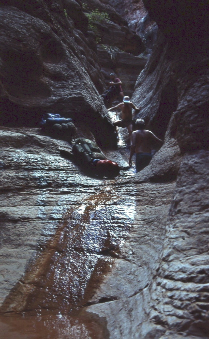
We were all up at the first hint of light and began looking around at the aftermath. Stan soon found my pack lodged under some driftwood only 20-30 feet from where I had left it. It never quite made it into the main channel. Everything inside the pack was wet and a little muddy, but otherwise fine. Even my camera was OK – I had stored it in a plastic bag inside the pack. But George was not so lucky. All of his stuff was washed away. Soon someone found his pack (nearly empty) which had not gone very far. Nothing else of his was visible nearby. All of our commissary gear (pots, stoves, fuel, etc.) was still on top of a rock where we left it, but the water had come up to within inches of washing it all away.
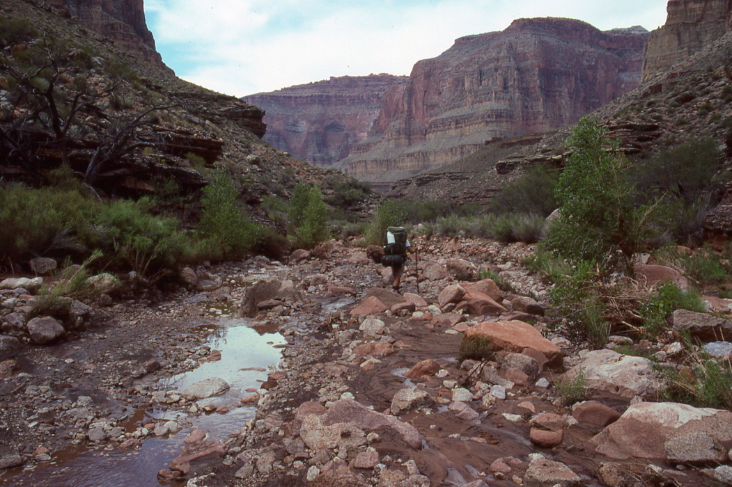
After a few hours of trying to clean and reorganize our gear, it was decided that we would hike down only as far as the side stream coming down from Tapeats Spring and make camp there. We could hike out the next day from there via the Bill Hall trail (or we could continue on down to the river and get help from a raft trip, if necessary). I cleaned out the cut on my foot and covered it with gauze and moleskin. I couldn’t put much weight on my heal because of the pain. Shortly after
starting down the creek we began finding some of George’s stuff – first a sock, then a shirt, etc. Over the next two miles of creek bottom we found nearly all of George’s equipment. It was jammed under rocks and in among the driftwood and other debris. But we found only one boot. And his sleeping bag was scattered over a half-mile of creek bottom in dozens of pieces. George’s shirt collar and cuffs were bloated with silt – very odd. He had to make slits with his knife to get out the silt. Two water bottles lost by Ilchuk were never found.
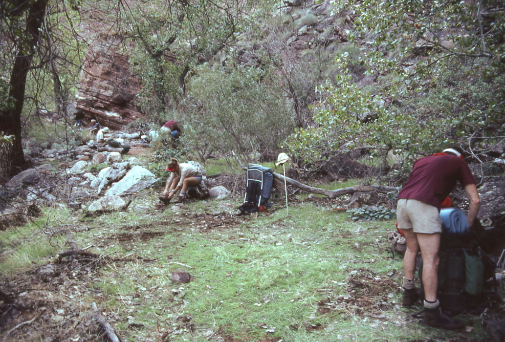
Crazy Jug canyon had clear water flowing from it so we stopped there for a long break. We rinsed out the dirtiest and most important pieces of clothing and hung them outside our packs to dry. A while later we stopped for lunch.
We found a nice, grassy campsite just above the canyon narrows. That night George decided that he could probably continue on with the rest of the trip with only one boot and no sleeping bag. He was worried about the tennis shoe lasting for 11 days, but he figured it could be repaired if necessary (I had some good rubber cement and Jarold had an awl with super-strong nylon thread).
Although a little cloudy, I decided not to set up my tent. I don't like being cramped up in a small tent all night, and I like being able to see the stars. So unless rain looks likely, I usually opt to sleep in the open.
September 25.
Today was my day (and Stan’s) for commissary duty, which began by cleaning up after breakfast. We decided that in order to continue with the original plans, we would need to make up for lost time (distance) in the next four days because Day 7 was to be a very long day away from water and we had to start that day at the very beginning of the dry stretch or we wouldn’t be able to make it in one day.
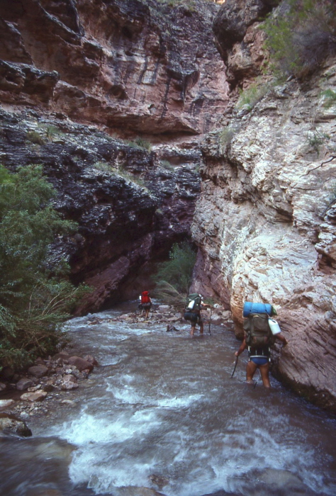
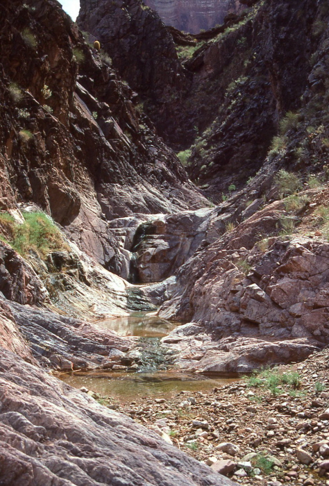
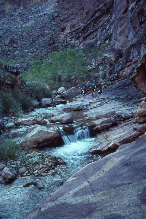
After about an hour we entered the
Tapeats narrows.
We had to wade through the water for about half a mile (I used my Aqua Socks). Once through the narrows we put our boots back on and soon hit the Thunder River trail coming up from the river, which was about two miles downstream. Gary stopped to take photos of Tapeats Creek. We had lunch about a half mile from the river, just upstream from the lower narrows. The canyon opened up, the
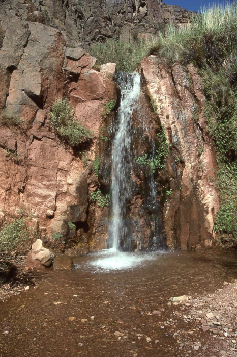
views were wonderful, and the hiking was easy. The weather was warming up fast, and we all went swimming in the large pools of Tapeats Creek. After lunch we started up a long ramp which would take us to the top of the Bass Formation directly above the mouth of Tapeats Creek. Although not strictly a trail, this section between Tapeats Creek and Stone Creek has been used enough that a pretty good trail has developed. We arrived at Stone Creek after about two hours of walking. We stopped for nearly an hour at a small
waterfall and took showers. The air temperature was about 80.
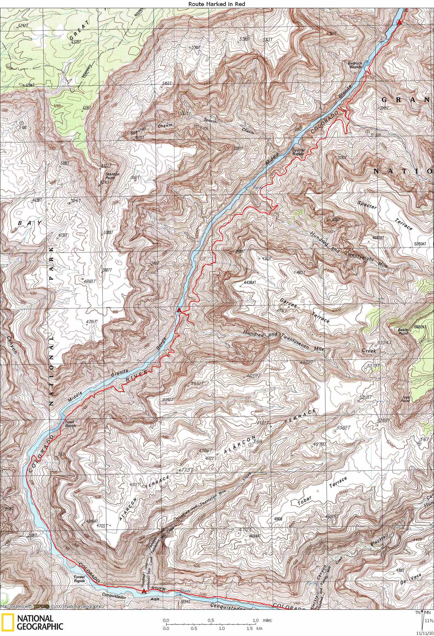
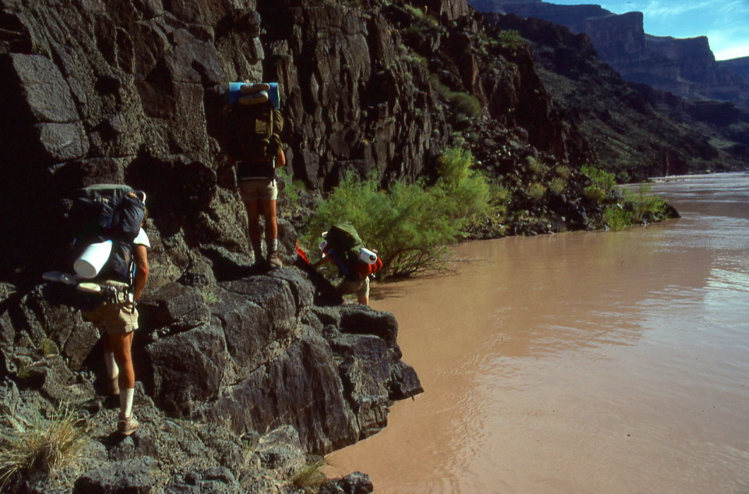
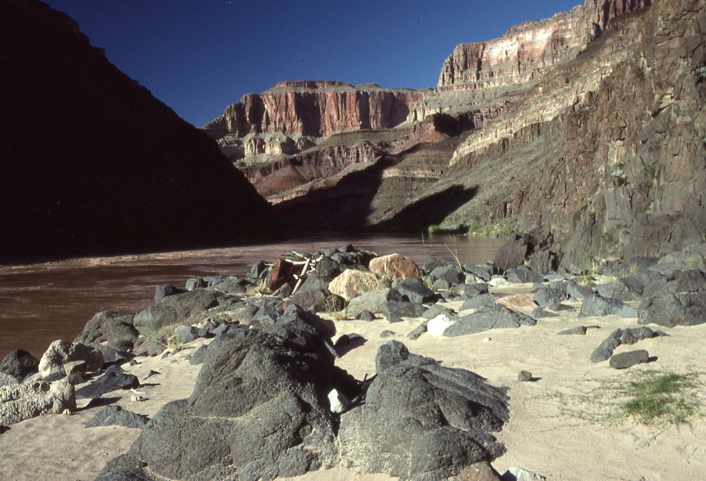
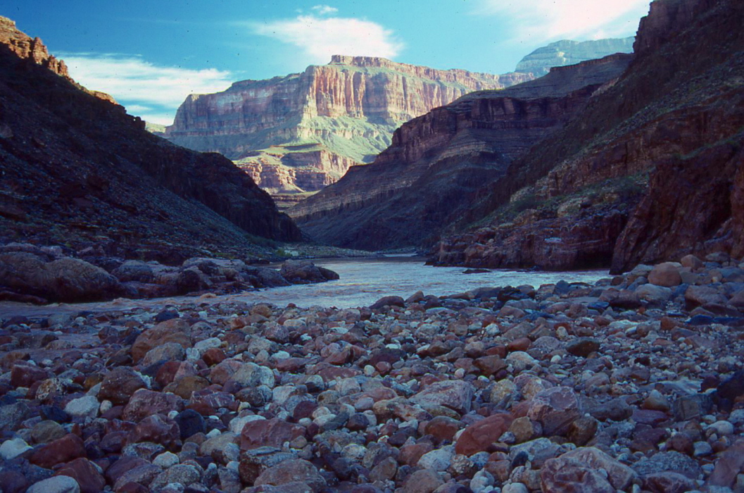
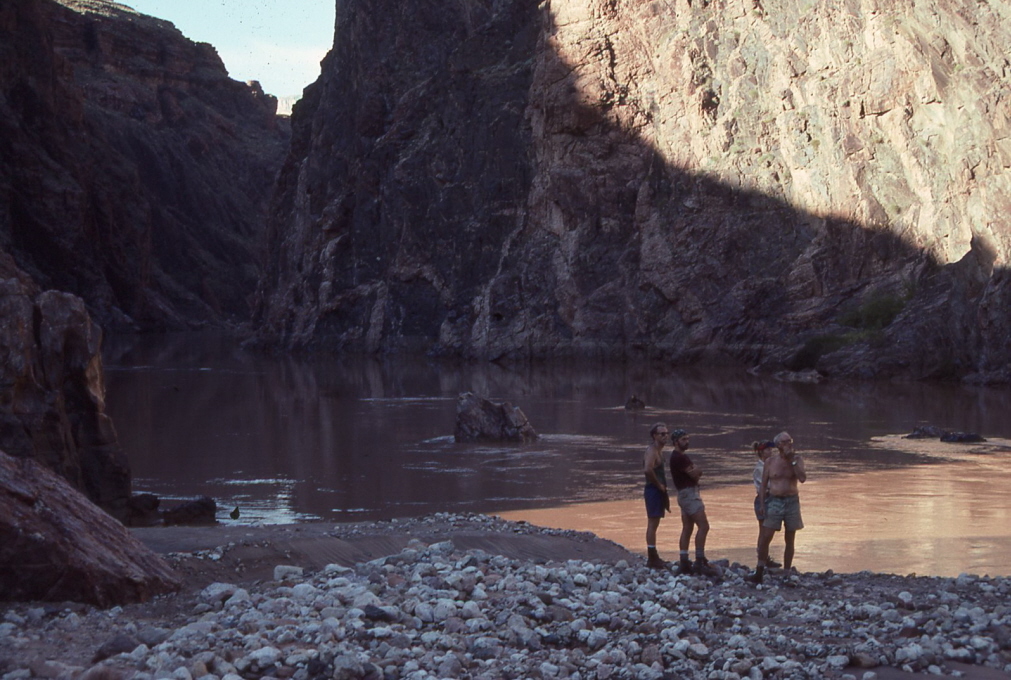
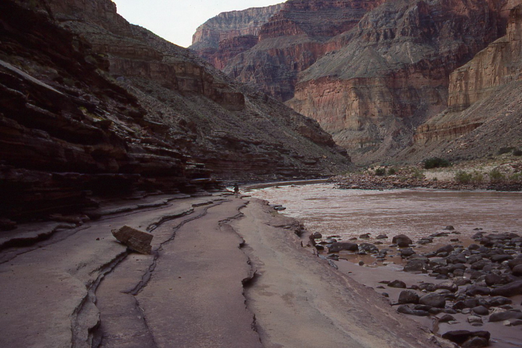
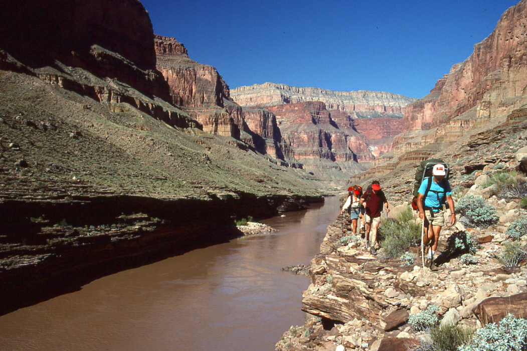
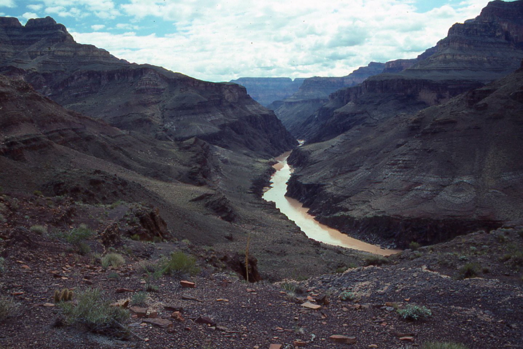
It was a short walk down Stone Creek to the Colorado and then along the Colorado to Gallaway. We were now entering the section of the Colorado called Middle Granite Gorge. We were hoping to get to Bedrock Canyon for the night, but the Colorado was running high (about 30,000 CFS) so the route along the
river’s edge was under water. We had to climb up and contour high above the Colorado on the steep-sloping basalt of the Bass Formation. This difficult stretch took so much time that we had to camp by the Colorado at the first accessible place, which was a
small beach at the mouth of an unnamed side canyon between Galloway and Bedrock. We arrived there, exhausted, at 16:30. The Colorado was very muddy. We filled the gallon Clorox bottles that each of us had brought and let the silt settle out. But not much had settled before we needed it for dinner. We sterilized the water with iodine tablets. This would turn out to be the usual pattern when we camped by the Colorado.
September 26.
I got up at 5:15 to prepare breakfast. We all packed quickly and started hiking at 7:00. We scrambled along the cliffs above the river until we reached Bedrock Canyon where we dropped down to the
beach
at the mouth. After a
short break
we climbed up onto some ledges and
continued to climb
a slowly rising ramp ledge.
The next side canyon we came to Steck calls Switch-Level Canyon
because you enter the canyon on top of the Bass Formation and leave on top of the Tapeats Sandstone (the Tonto Platform). We arrived at the canyon bottom around 9:40 where there was a small flow of
good water.
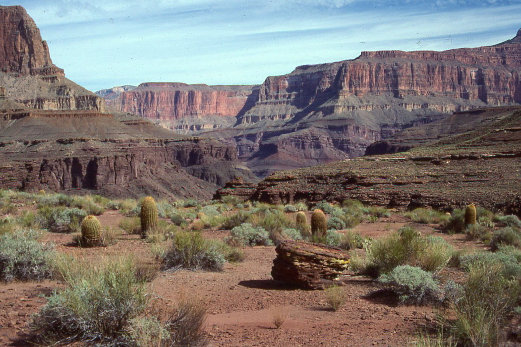
After a short break we climbed steeply out of the canyon and onto the Tonto. We followed some pretty good game trails for several miles, contouring high above the Colorado on the very edge of the Tapeats cliffs. The
views
were spectacular. When we reached
128-mile Creek,
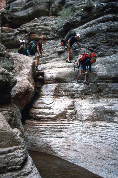
we had to contour over a mile in and away from the Colorado before we found a steep chute down to the clear flowing creek. We arrived about noon and had lunch. The exit chute was directly across from the entrance chute and it too was very steep. But once on top of the Tonto we were again able to follow game trails. We reached the overlook to 127-mile Creek around 15:45. Steck’s usual route is to contour around and away from the Colorado and then descend a steep chute to the creek and exit via another steep chute on the other side. But we wanted to get to the beach at the mouth of 127-mile to camp. George said that one could follow the creek bed down to the Colorado, but it is steep and narrow and may require lowering of packs with a rope. So we sought another route off the downstream nose of the canyon’s mouth. We still had to lower packs, but by 16:30 we were on the beach.
Since we didn’t want to retrace our steps the next morning, we needed to find an alternate route back on to the Tonto from the upstream side of 127-mile Creek. So while dinner was being prepared, I hiked up the creek and Jarold hiked upriver looking for an accessible break in the Tapeats. I found the going rather easy in the Tapeats narrows (and beautiful), and Jarold also found an exit point. I found several pools of good water. Since Jarold’s route was probably shorter than mine, it was decided to take his route the next morning.
September 27.
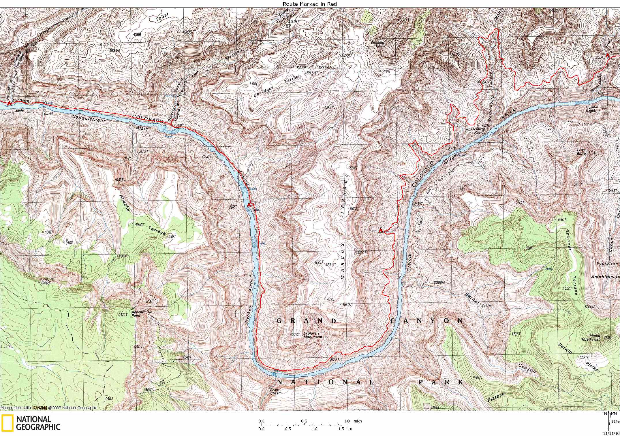
We broke camp at 7:15. Jarold’s route turned out to be very steep and involved a lot of difficult climbing. But the exposure was minimal and we were soon back on the Tonto.
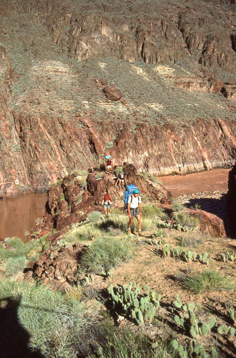
Again we followed deer and Bighorn trails, which greatly increased our speed. The trails are often obvious and easy to follow for a hundred yards or so, then they often fade away for a while. This makes it difficult for the lead person to stay in the lead for long. When he gets off the trail at these indistinct places and therefore slows down, the person behind him can often spot a better route and thus pass by and take the lead. Jarold and I swapped lead 5 or 6 times in the next two hours.
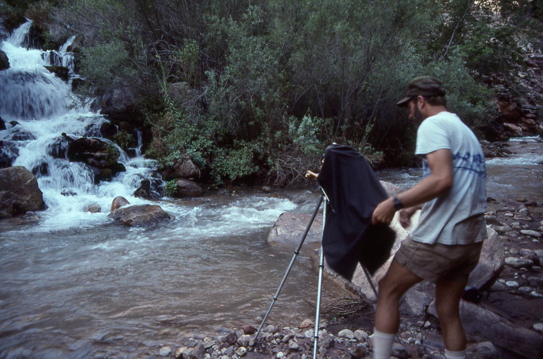
We followed the slowly descending Tapeats. Before we got to Fossil Canyon, we dropped to the river where we could walk along the edge. I found a beer floating in an eddy which I retrieved with a long stick. By 9:15 we were at Fossil Canyon, walking along sandstone sidewalks at the water’s edge. After a short rest, all but Gary moved on. He stayed to set up his large format camera and take pictures of the Canyon in the morning light.
After a short walk along the easy
sandstone sidewalks,
we came to a place where we could not continue along the Colorado because of a vertical cliff at the water’s edge. This turned out to be one of the most difficult and frustrating sections on the entire trip. It was difficult because it was hot (close to 90 with no shade) and because we were continually thwarted in our attempts to find a low route. In order to pass this small section of cliff, we had to climb very high above the Colorado on loose and crumbly rock, and through stands of cactus and catclaw.
We had lunch along the Colorado shortly after noon. We didn’t get started again until 1:15 because we had to wait for Gary. We walked along the river until we reached 122-mile Creek at 2:15. Some people wanted to stop here for the night and some (including me) wanted to continue on to Blacktail Canyon (another 90 minutes), where I had stashed four beers a month earlier while on a raft trip. But the cache was located about two hours beyond Blacktail, and that is where we must camp before starting the long waterless section. Since we could never make it to the cache that day (at least no one wanted to), we decided we may as well stay on the beach at the mouth of 122-mile Creek (dry). This would still make the next day rather short.
The beach was very large. Since we got there so early, we had time to take baths in the Colorado. I washed a lot of my clothes.
September 28.
Although we woke up early today, we got a late start because Jarold repaired some of our packs using is awl. My shoulder straps were becoming frayed at the lower attachment points. Jarold sewed another piece of webbing on the existing one, making a very sturdy repair. We didn’t need to get an early start because the day would be short, but Marcey was getting annoyed at the delay – she wanted to start early to avoid the heat. By 8:15 we were on our way.
The walking was easy along the
Tapeats ledges
about 80 feet above the river. We took our time and didn’t arrive at Blacktail until 10:00. We spent an hour at Blacktail, exploring the canyon narrows and looking for fossils. I retrieved my beers and we filled our water bottles from the pools in Blacktail. It was getting hot.
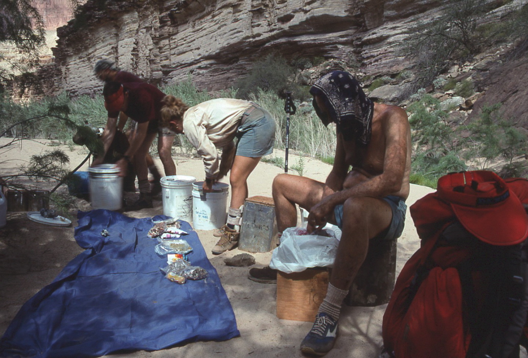
It was fairly easy walking along the talus blocks at the river’s edge. We arrived at our cache around 1:15. The first thing we had to do was retrieve the cache, because we were completely out of food (lunch). The cache was at the base of a 50-foot rock tower about 100 feet above the Colorado. The food was stored in 5 gallon metal and plastic cans. The cache was placed there in July by Gary and George. At that time they thought 16 people were going to be on the trip, so the
cache
had food for 16. Since we were only 10, we ate as much food as we could that day and the next morning. We left the extra food in the cans, along with our trash, and put them back at the base of the rock tower. George or Gary would arrange for a raft trip to pick up the cans later.
The route from the cache involved a very steep climb up the Tapeats to the Tonto. George and Gary found this route when they were on the raft trip in July (George’s original route gained the top of the Tapeats at Blacktail). Since the route involved 200-300 feet of very steep climbing, George suggested that we climb up to the Tonto that afternoon and stash water for the next day, thus avoiding having to climb the cliff with a heavy load of water (we would each need 4-6 quarts that day). I had noticed some stagnant pools of water at the mouth of a steep and narrow canyon nearby, so I thought that maybe there would be water near the top. I climbed up the exit route and did find a small pool of stagnant water (filled with mosquito larvae and covered with algae). I filled my water bag and left it under a ledge near the pool, then climbed down to tell the others. Thus a climb to the top with water that afternoon was not necessary and we could lighten our packs for the morning climb by about 10 pounds.
We drank the beers that afternoon and ate like pigs that night. Gary read to us from an unpublished manuscript written by the first person to be stationed at the bottom of the Canyon to measure Colorado River flow rates (1920's?).
September 29.
Again my day for commissary duty. We got up very early and were climbing the Tapeats cliff by 7:00. We filled our water bottles at the small pool and I picked up my water bag.
Today would be long, hot and dry. We would start out heading directly south, make a long counterclockwise turn, and end up heading directly north. We soon found a very good burro trail on the Tonto at the edge of the Tapeats cliffs. The going was very easy. At times the burro trail could have passed for a maintained trail. We contoured in and out of numerous side canyons, as usual.
At 8:15 we spotted a small raft party making breakfast at their campsite across the river. We yelled to them asking what was for breakfast and they said biscuits and gravy. They said they would throw some of the biscuits up to us but they were too light (implying how good they were). But of course throwing them would have been impossible since we were about 250 feet above the Colorado on the other side.
A short time later we crossed a fault (Monument Fold) where the Tapeats is shifted about 100 feet higher. We followed the burro trail which contoured into the fault ravine and up onto the higher Tonto. The burro trail continued along the edge of the Tapeats, several hundred feet above the Colorado.
At 10:15 we stopped at some shade at the drainage coming down from Explorers Monument. It was getting hot and shade was scarce. We decided to have lunch early since we were not sure when the next shade would come.
After lunch we continued on for several more hours in the hot sun. Around 15:00 we were at the river access point. This is where George suggested that a group of volunteers go down to the Colorado to fetch water. George said that the spring where we planned to stop for the night probably had a high magnesium sulfate content. He had gotten diarrhea all three times he had drunk from the spring (although his companions didn’t). So George did not recommend we drink the water unless it was an emergency. The route to the river was down a very steep and possibly dangerous chute in the Tapeats. Luckily we found a large pool of rain water at the top of the chute. We filled all of our water containers (including the Clorox bottles) and hauled it about one more mile to the spring.
The spring was down a shallow ravine in the Tapeats. The water was clear and we used it for washing. The Tapeats provided numerous overhanging ledges ideal for camping. The one problem turned out to be mosquitoes. Marcey and Jarold, who were camped close to the spring, had to move to higher ground in the middle of the night to get away from the mosquitoes. It was too hot to cover up inside a sleeping bag.
Around sunset I hiked out to a point with a spectacular panoramic
view
overlooking the Colorado. Later Gary read some more from the unpublished manuscript.
September 30.
I had to get up at 5:00 to start breakfast. Today was expected to be long and waterless. Our destination was Hakatai Canyon. We were on the
burro trail
at 7:05.
Except for a few spots where we lost the trail for 30 minutes or so, the going was easy and flat. But the side canyons were getting larger. We had to contour around several large side canyons which took nearly an hour apiece. The big side canyon for the day was Walthenberg. We spent three hours getting around it. We had lunch in the shade at the head of Walthenberg, near a small flow of water.
The ramp into Hakatai was, as George described in his book, hard to find. I bet it would have taken me an hour or more to find it without George. But George knew right where to go. We headed down a shallow ravine and then cut left and started contouring around on the ramp below the steep Hakatai Shale cliff. This route was used by W.W. Bass and Walthenberg to get from Hakatai Canyon to Walthenberg Canyon, so some improvements to the route were probably made by them. The
views
down into Hakatai and across to Fan Island were awesome. At 15:30 we reached the bottom of Hakatai Canyon, where there were only a few small seep-fed pools.
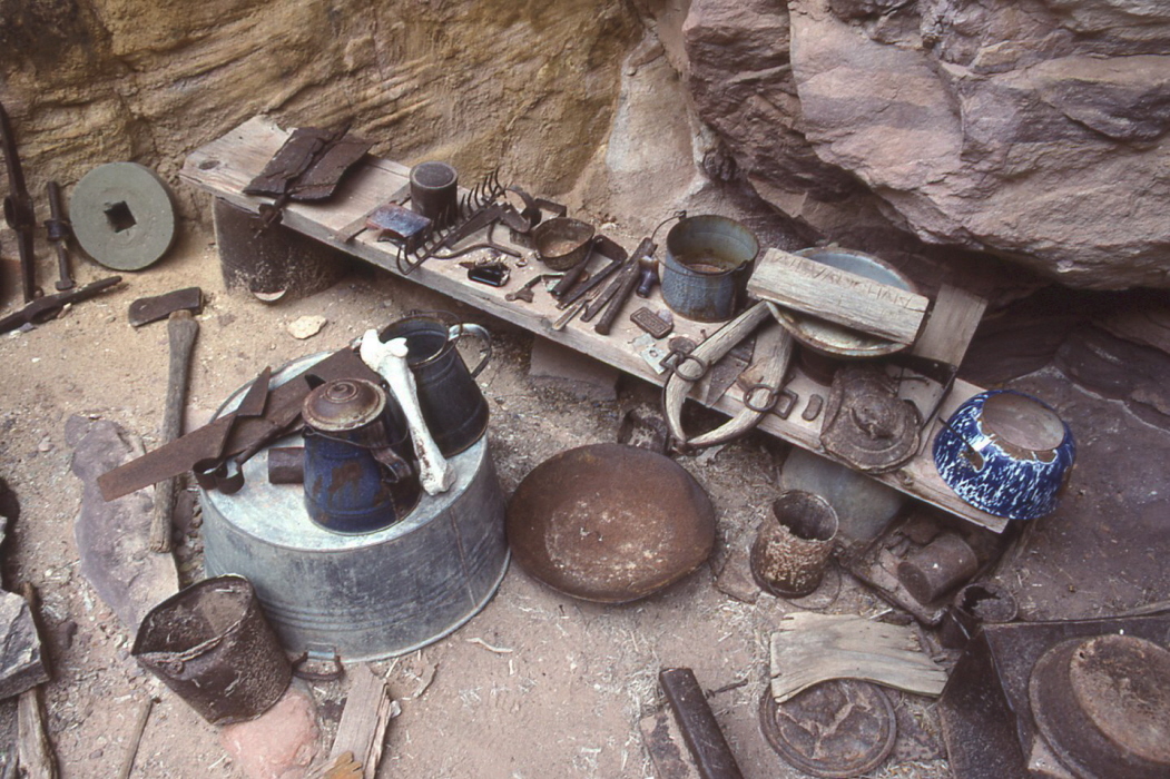
Bass's asbestos mines are located in Hakatai. We counted three small shafts near where we camped. A sign said to say out of the mines because of the asbestos danger. Under an overhang near one of the mines was a lot of
old mining equipment:
shovel, axe, coffee pot, cans, burro harness, etc.
The water from the potholes tasted very salty. It was so salty I had trouble drinking it. I think some of the salt was probably magnesium sulfate because I got a touch of diarrhea which lasted all the next day (of course I had to drink the water for most of the next day’s hike).
It was cloudy at sundown, so I set up my tent on the rocks.
October 1.
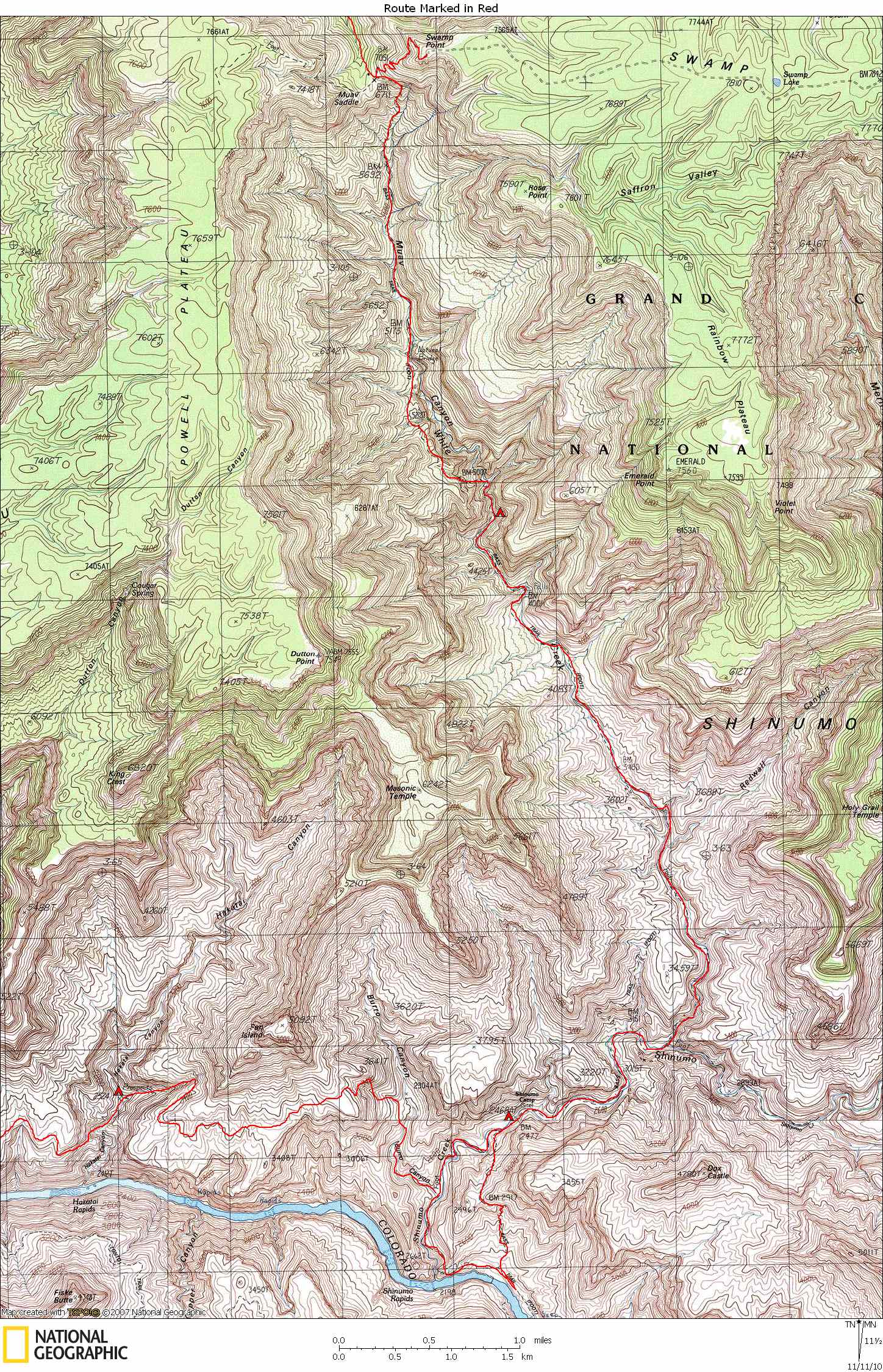
We got started at 7:30, a little later than usual. Bass had built a trail from Hakatai to Shinumo Creek, our destination for the day. But most of the trail is now non-existent. George said that the first section out of Hakatai was so bad that it was better to just climb straight out of Hakatai via a
steep chute.
And it was quite steep, requiring frequent use of our hands. In a few places we had to hand our packs up a ledge to someone on top. But once we got on the Tonto the going was again easy until we had to drop in to Burro Canyon, a tributary to Shinumo. From Burro we contoured up over a sloping ridge and then descended into Shinumo, following Bass’s "trail" most of the way.
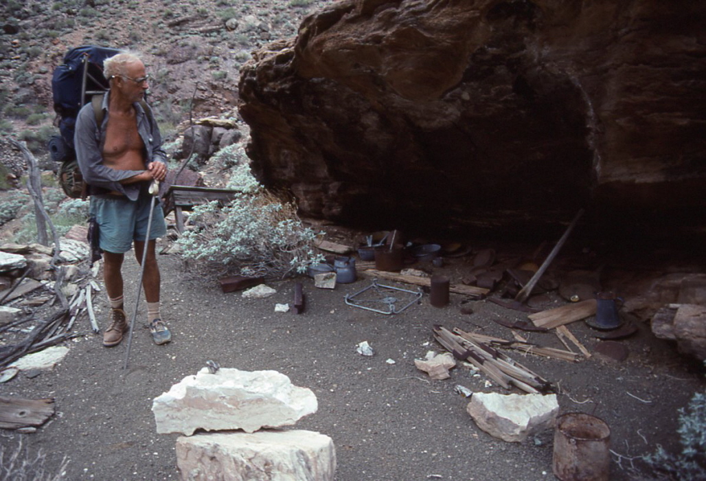
Shinumo Creek is like a mountain stream, full of clear, cold water. We walked up the creek for about half a mile to Bass Historical Site, where Bass had his base camp, fruit orchard, garden, and tourist tent camp. Lots of
old mining equipment
was scattered all over, including a wood-burning stove (in pieces), shovels, axes, a grinding wheel, wood, nails, cans, bottles, and lots of small hand tools and pieces of hardware. There was a lot of asbestos laying around too – strands about 1-2 inches long.
I took a bath and washed clothes. It was getting cloudy so I set up my tent. Good thing, too, because it rained steadily all night.
Before bed, George recited The Raven, by Edgar Allen Poe.
October 2.
Layover day. Got up late. The weather cleared all morning and by noon it was warm and sunny. Just after lunch, Gary, both Jims, Doug, and I took a day hike to the river. First we took the
high route
up over a ridge and down to the Colorado, to a point about a quarter mile upriver from the mouth of Shinumo. You could not walk along the river to Shinumo because of cliffs. We left the beach via another lower trail that ends up at Shinumo Creek several hundred yards from the mouth, just above a large chockstone. There were two ways to bypass the chockstone: Jump into the pool below the chockstone, or squirm down through a small hole (with the creek pouring through it) next to the chockstone. Gary, Ilchuck, and Doug squirmed through the hole, but the hole was not big enough for me. So I jumped into the pool. To get back up I had to climb back around on some very steep cliffs, whereas the others could climb back up through the hole. The route back to camp was along the creek.
October 3.
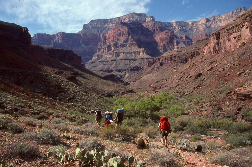
My last day to cook. This is the next to the last day of the trip, and the first long uphill grunt towards the rim. The North Bass Trail is considered difficult primarily because large sections are non-existent. The route follows the creek bed most the way, with diversions around waterfalls and other obstacles.
Within an hour we encountered the first backpackers we had seen on the entire trip. The canyon was spectacular with
lots of water
and cottonwood trees. Late in the morning we entered the Tapeats which formed a narrow canyon replete with lush hanging gardens. Lots of vegetation. We had lunch near the top of the Tapeats, just below an impassible section of narrows and a spectacular chockstone, which was easily bypassed on the right.
At the top of the Tapeats we passed through a backpacker’s camp, but saw no one. A few hours later we were in the Muav Limestone, just below the Redwall, our destination for the day. There was water flowing along smooth limestone chutes connecting pools of water. There were many good, flat ledges to lay out sleeping bags.
At about 17:00, two backpackers strolled into camp. They were the ones we didn’t see as we passed through their camp earlier. They asked us how long we had been out and what our route had been. When we told them, they asked if we were following the route described in Steck’s book. We said yes and introduced them to George. One of them owned a mountaineering store in Logan, Utah. They were delighted to meet George, and George was delighted that they knew who he was.
We all stayed up and talked a little later than usual, knowing that this was our last night together. The moon was nearly full now. It was so bright you could almost read by it.
October 4.
I had to get up early again to cook breakfast. We had a short but very steep climb ahead of us. The rim was 3500 feet above us, but because we had to climb up and over a couple of obstacles, our total elevation gain would be more like 4000 feet. But our packs were light. We got started by 7:00.
After about 30 minutes of following the creek bed, we began climbing
out of the bed and directly up a very steep redwall slope. By 8:30 we were at the
top of the Redwall,
where we took a long break. We had already climbed 1200 feet.
The next section was very confusing with lots of bushwhacking. I should have put on my long pants, but it was getting hot. Eventually we got back into the drainage and continued directly up it for a couple of hours. Around 10:30 we started up the
last major climb
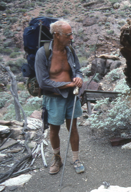
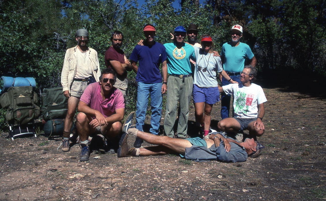
to Muav Saddle (and the old cabin). The trail was very steep – almost no switchbacks. We reached the springs at the base of the Coconino (just below Muav Saddle) around noon. I got another quart of water and continued on to the saddle. Although we had planned to have lunch at Muav Saddle, we decided to continue on to the rim and have lunch there. We were on the rim and back at the cars at 13:00. We took a group photo which shows George wearing one boot and one tennis shoe, as he did for 11 days.
On the Saturday before the start of the trip I filled my cooler with three blocks of ice, three six-packs of beer, and filled in the rest of the spaces in the cooler with ice cubes. When I got to the trailhead I parked my Cherokee in the shade of the pine trees and covered the cooler with a sleeping bag. And it all paid off because we had, after 12 days of hiking, three six-packs of ice cold beer. There was still ice in the cooler.
We drove back to the paved road and said our goodbyes there. I drove to Richfield, Utah for the night. |