|
Backpack to Indian Hollow via Flipoff Route
NOTE: Click on Hypertext to view photos.
Preface. I feel lucky that this trip even took place. My friends Bert, Marcey, Ben and I (along with some others) had done Steck’s Deer Creek/Kanab Creek Loop last October. Jim, one of our regular hiking companions, missed the October trip and wanted to do it in the spring. So Bert organized another trip into the area, but none of us wanted to hike along the river from Deer Creek to Kanab. And I wanted to hike around Fishtail Mesa. I had attempted it in November by myself, but the dry conditions stopped me. As March neared, Jim had to bail again, and the huge snowfall on the north rim would prevent us from getting to either Indian Hollow campground or Sowats Point trailhead. I was determined to find another way in. Bert, who had once hiked in via Hack Canyon (and didn’t like it much), vetoed that option. Besides, it would have added an extra day just to get into Indian Hollow. So I posted a question on the Yahoo Grand Canyon Hiking forum asking for alternate access route suggestions. Several people suggested Flipoff and/or Chamberlain. The road into Flipoff was about 1300 feet lower than the winter road to Indian Hollow campground, so we thought we might have a shot. Then came a huge snowstorm a few weeks before our trip. But I was optimistic, and the weather turned warm and dry for a couple of weeks before our start date. We decided to go for it.
Trip members included Skip, Bert, Bruce, Ben, Marcey, Jane, Susan and me.
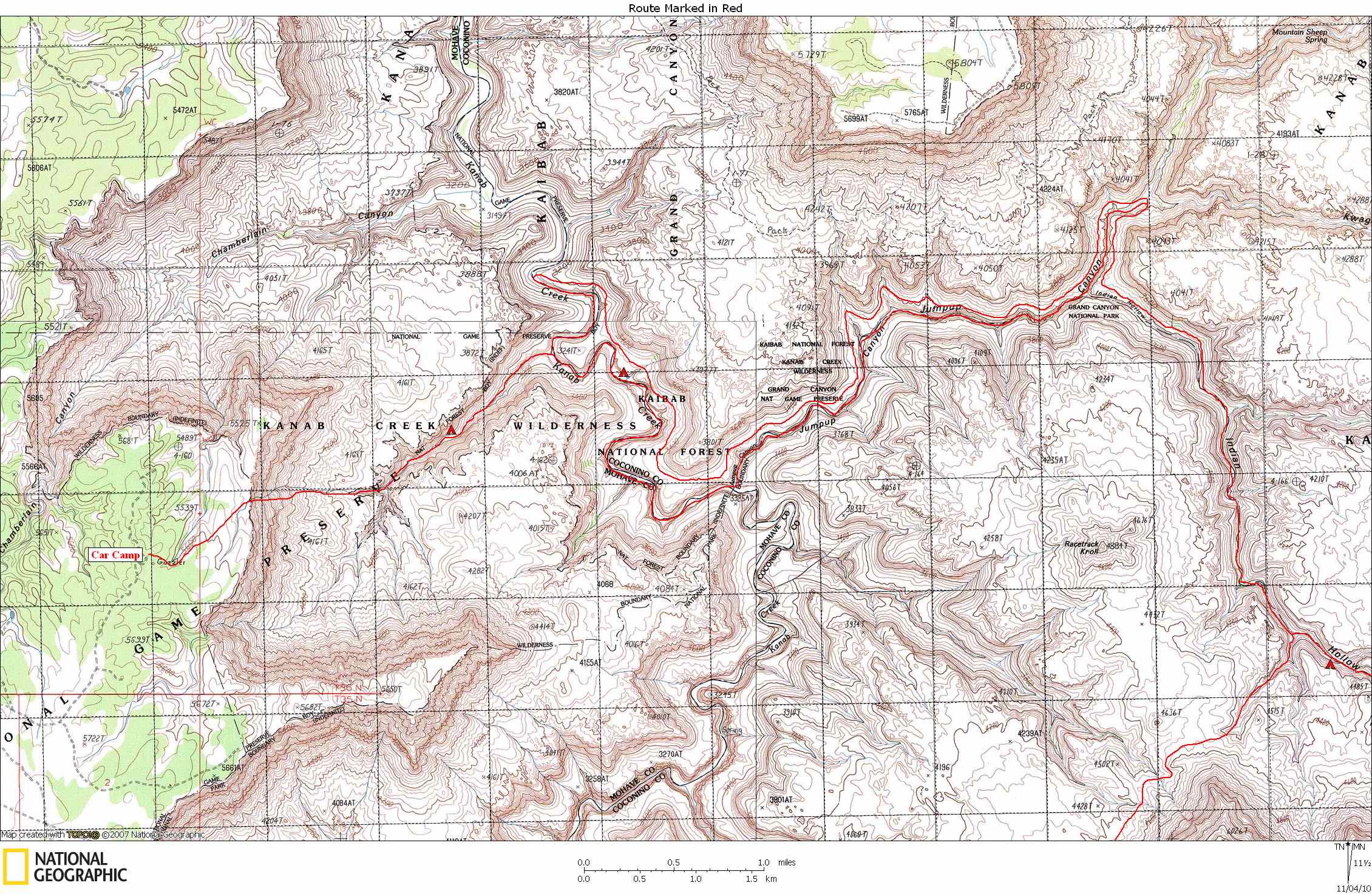
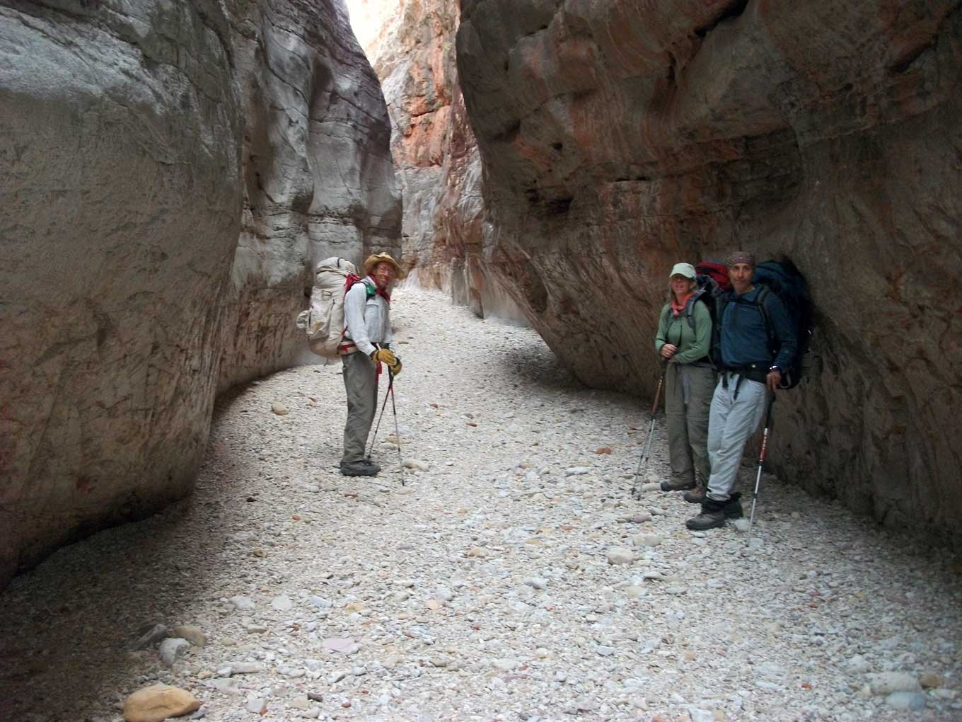
March 27, 2010. I had flown into Las Vegas the week before with my daughter. We did a 6-day trip from the S rim. This morning, Brianna flew back to Boulder and I met a couple of friends who flew in that morning. We rented a car and drove to Kanab, where we met 4 others. There would be 8 of us all together. Then off to the Flipoff rim. Flipoff, by the way, is an un-named canyon just south of Chamberlain. We headed down the Toroweap road for quite a ways before turning off and heading for Flipoff. The roads were in great shape. Total distance on the dirt roads was about 55 miles. We arrived at our starting point around 16:00 where we set up camp for the night. We were less than a mile from the rim. We hiked out to the rim before sunset to make sure we could find the descent route. It was easy to find, thanks to information I got from Doug Nering, Rich Rudow, and Dave Mortenson. Many thanks.
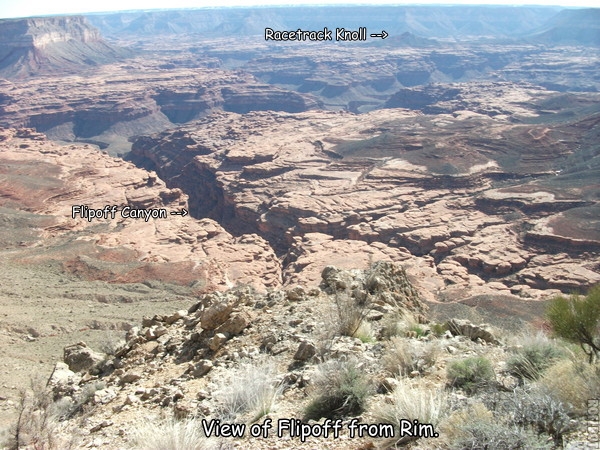
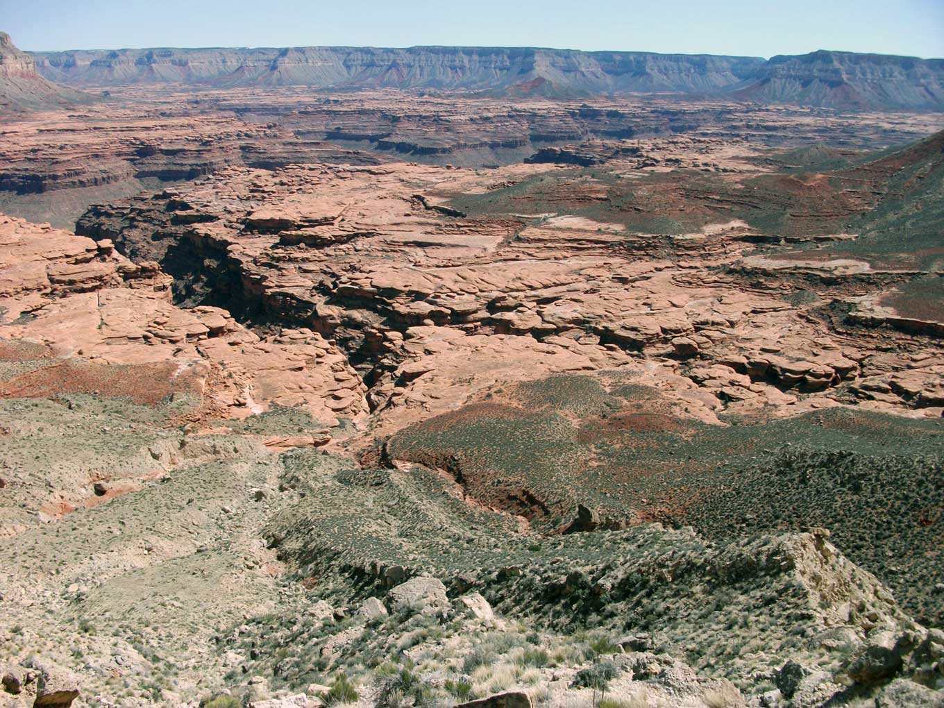
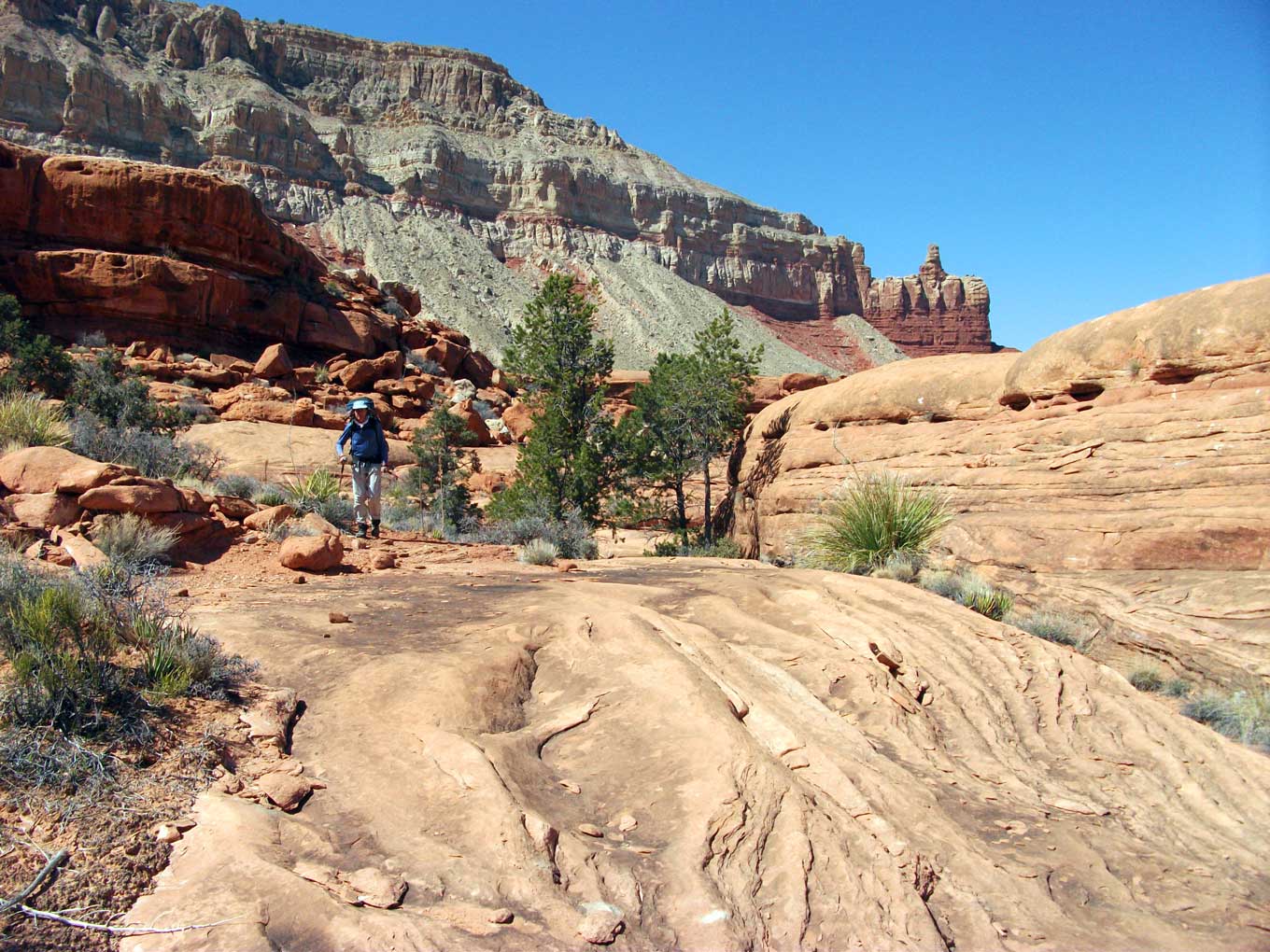
March 28, 2010. We were up at the first hint of light and were soon gazing into the vast expanse of the
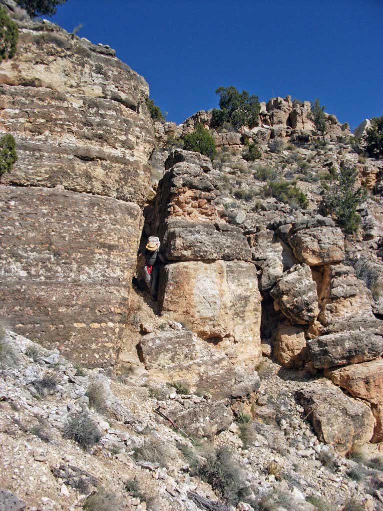
Esplanade below us. Racetrack Knoll, which I had climbed last November, looked like a tiny bump, nearly lost in the vastness. After a few minutes of silence, the eight of us enthusiastically started down. The first obstacle was a cliff band of Kaibab limestone. There was a nice
crack
just wide enough to get through that provided an easy way through.
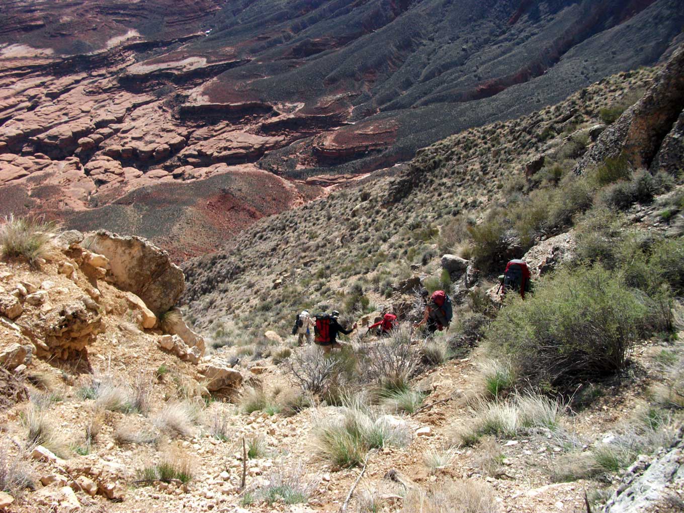
Then began the
talus
and the tedious hike down about
1700 feet
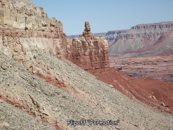
to the Esplanade. Soon the infamous
Flipoff Formation
came into view, which explains the name of the canyon and the route.
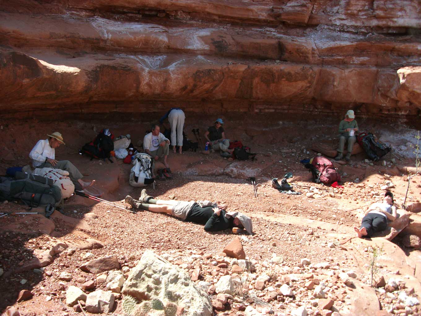
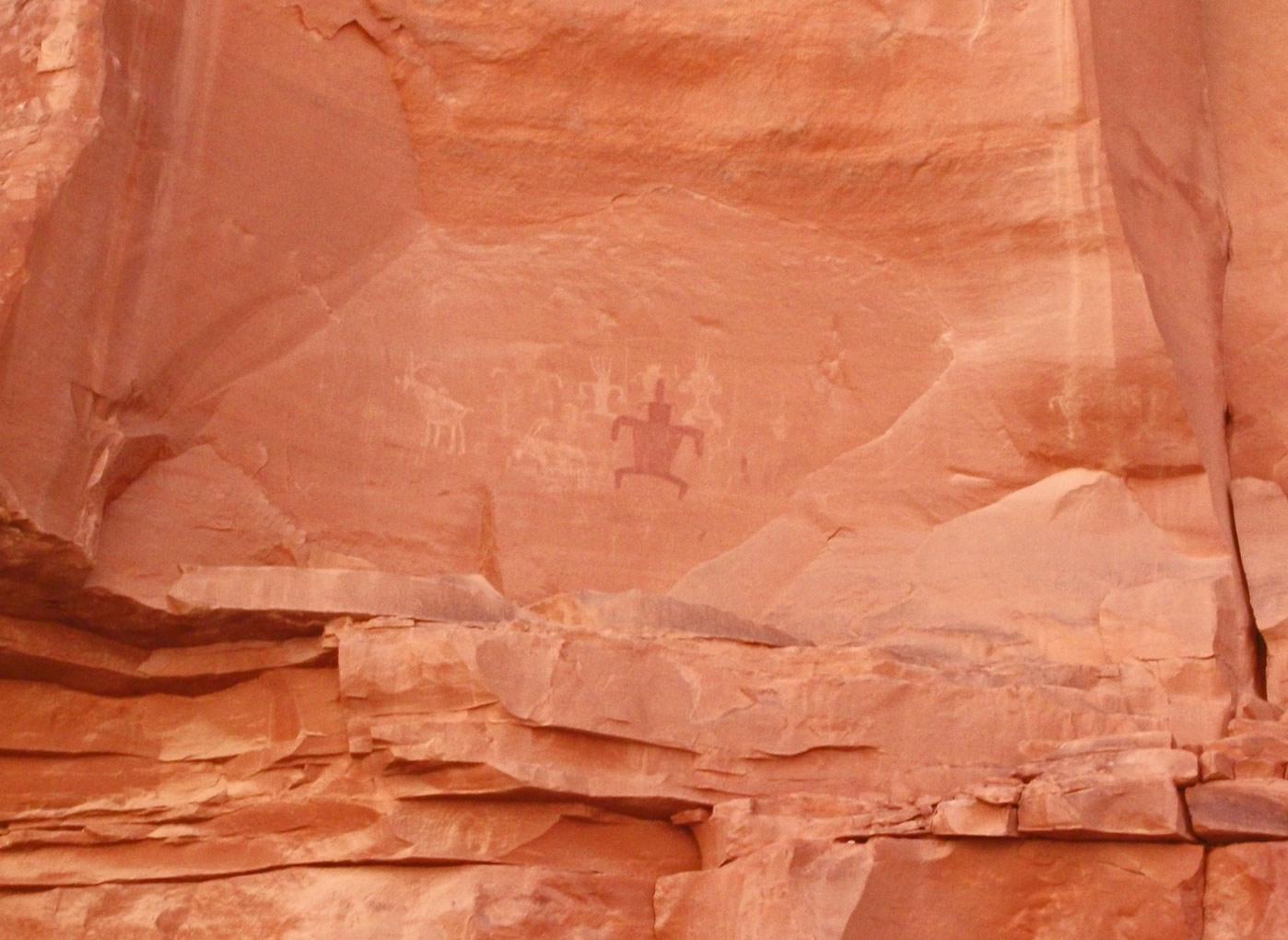
It was already afternoon by the time we got to the Esplanade. We stopped in the shade for
lunch
and found some
rock art
nearby, as well as some full potholes. After lunch we
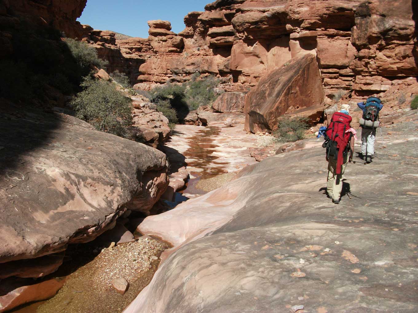
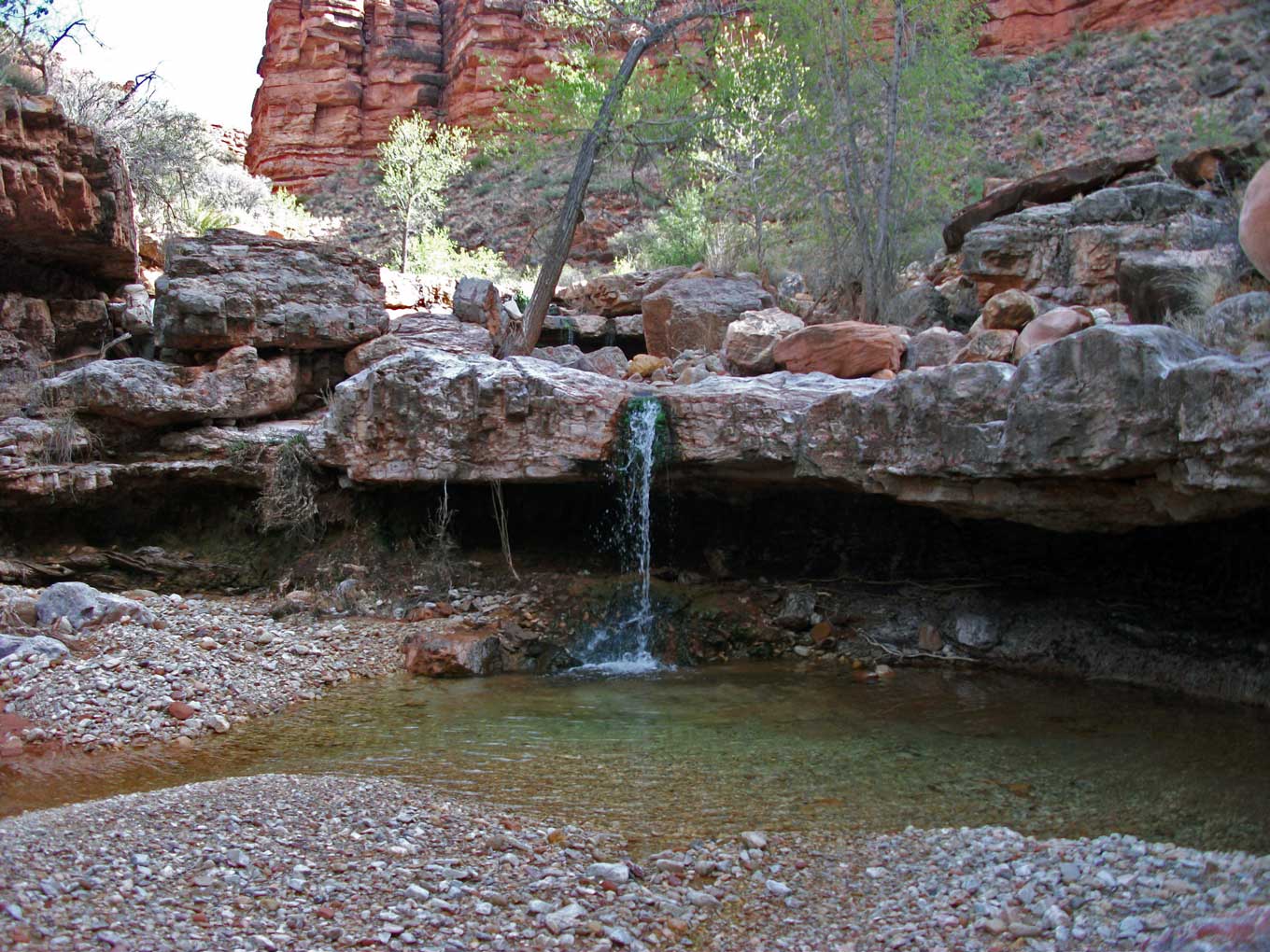
started down Flipoff Canyon
through the Supai. Water was flowing nearly the entire way. A little over half way down we came to a beautiful
Cottonwood grove,
and probably a fairly reliable spring area during normal years. The entire canyon was gorgeous. I have a special love for well-watered Supai canyons.
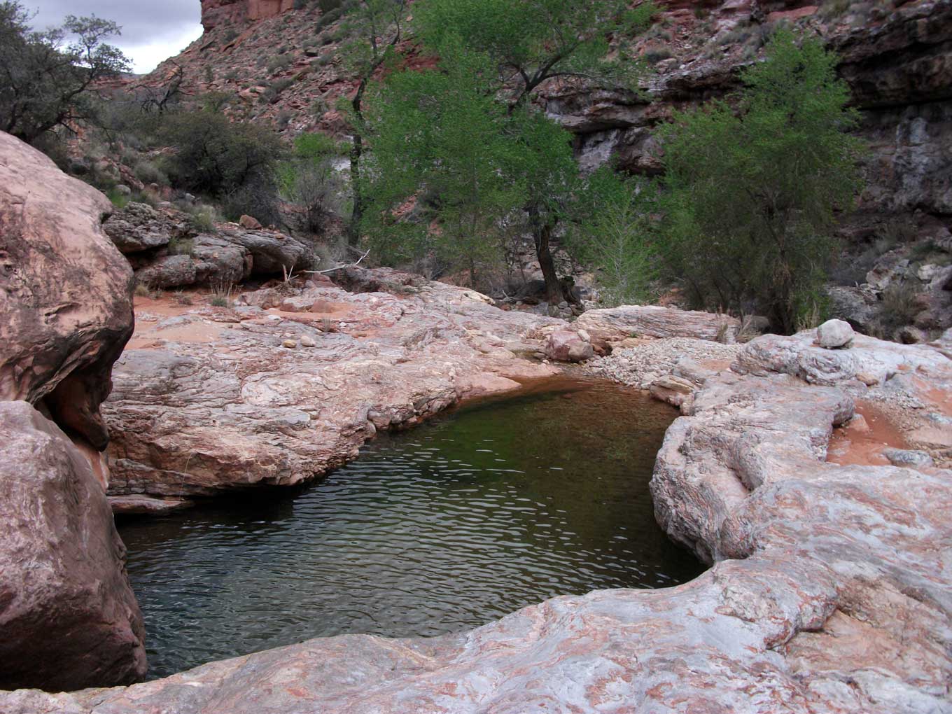
When we reached Kanab Creek (dry), Susan was complaining about an extremely sore knee. Apparently she was having some trouble from the start, but it continued to worsen the farther we went. She could neither straighten nor extend her knee completely. Ben, who is a doctor, thought it was something unusual -- not an ACL or meniscus tear. But it was debilitating. We decided to stop and camp at the first opportunity. We found a very nice pothole on creek left a little over half a mile below Flipoff. It is out of sight in a cleft in the canyon wall. I believe it is shown on the 7.5-minute quad.
That eveninig we talked about what we should do. If Susan were unable to hike the next morning, we would leave her there, with food, etc., and meet her on our way out in four days. We had originally wanted to exit via Chamberlain, but because the route description was a little sketchy, we decided that we would exit via Flipoff (better the devil you know...).
March 29, 2010. Susan was no better in the morning. She was fine with staying by herself. She had a camera with several lenses, a book and a journal. Susan said that she might want to move up into Flipoff in a day or so, if her knee felt better. Since we didn't know for sure if we would be coming down or up Kanab, she was to leave a cairn with a note at the mouth of Flipoff if she had gone up that way. If we were coming from upcanyon, and there was no note, we would hike down to her campsite to get her. If she was still doing poorly, we figured we would have to hike out, drive to Kanab, and call for a helicopter rescue. Susan didn't want to hear about a helicopter. She had been on a mountain rescue team for years and said her injury was not life threatening. But if you can't get out of the canyon, then it is.
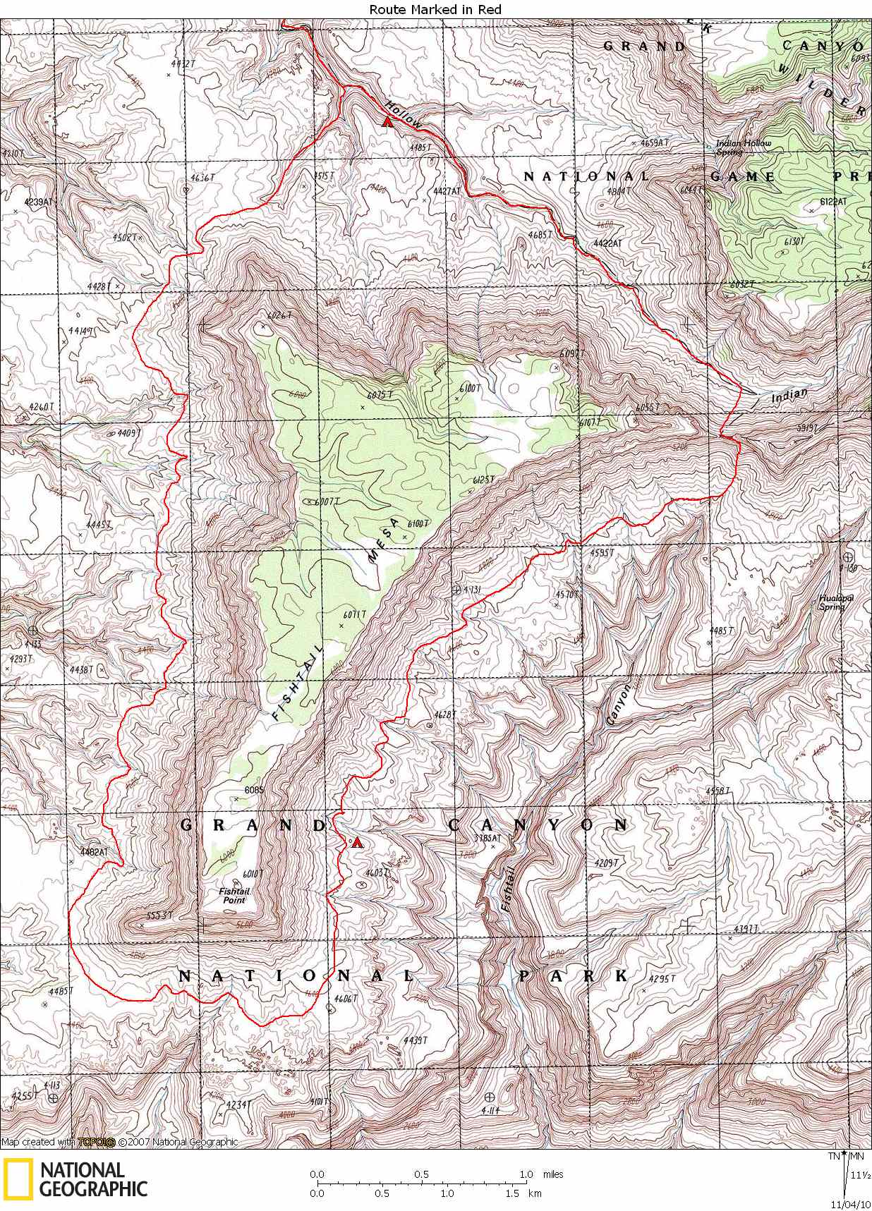
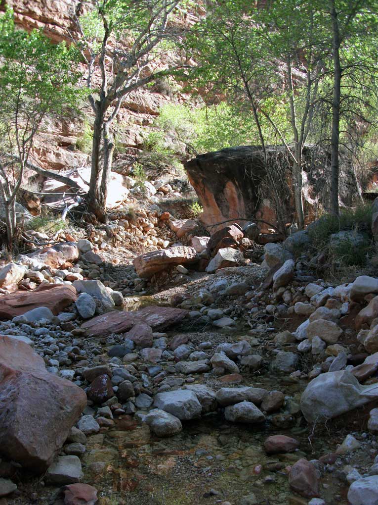
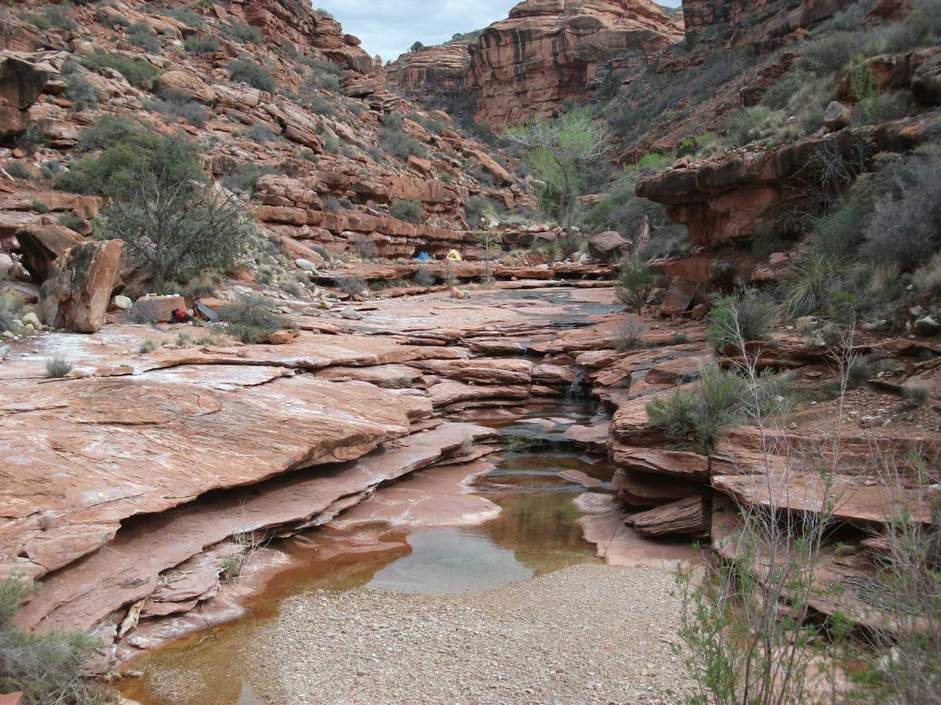
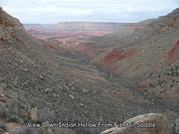
So off we went, heading for Jumpup. We turned up
Jumpup
and continued past Indian Hollow to Kwagunt Hollow. There we got on top of the Redwall and followed it around and into Indian Hollow, thus avoiding Steck's Obstacle Pool. Water was flowing nearly the entire length of Indian Hollow. Another spectacular
well-watered
Supai canyon! We all took a swim in Steck's
Over-Your-Head Pool,
just before the sun disappeared behind the canyon walls. We continued on to the side canyon that provides access to the Esplanade. It is the canyon that branches around the point labeled 4515T on the topo map. There is
great camping
a few hundred yards farther up Indian Hollow.
The plan was to start out early the next morning and hike around Fishtail Mesa in two days, returning to roughly the same place we were camping. That evening, Bruce, Skip, and Jane decided that they would rather not do Fishtail Mesa, but would like some time to relax, and perhaps climb Racetrack Knoll. So Bert, Marcey, Ben and I would start out early the next day, with only two lunches, one breakfast, and one dinner. We would leave the rest of the food at camp.
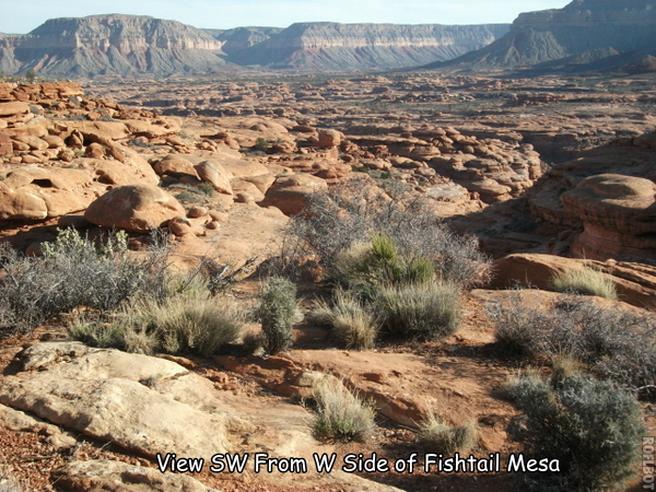
March 30, 2010. We got up early again and were hiking by 7:00. We reached the Esplanade at 8:00. And from there the going was slower. We wanted to get more than half way around Fishtail, just to make sure we would be back at the end of the second day. Water was much scarcer than I had anticipated. But the temperatures were probably only in the 50s and 60s, and except for the wind, great hiking weather. This section of the Esplanade is not what I think of when I think of Esplanade hiking. Almost all the time we were on mounds of Hermit Shale, not Esplanade Sandstone. However, there were notable
exceptions.
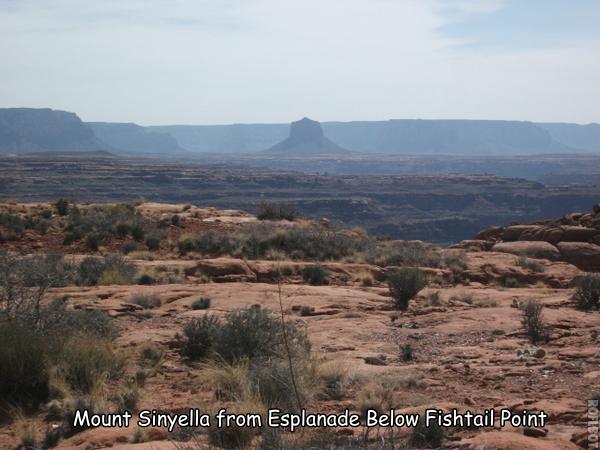
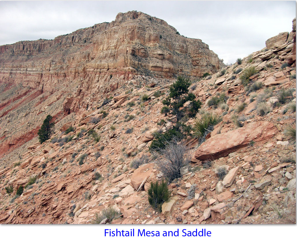
There were endless canyon systems to cross, with deep gullies and lots of up and down. Nothing like the Esplanade along the Thunder River Trail, below Great Thumb Mesa, or on the Tuckup Trail. It was hard, uninspiring hiking. We found enough water along the way, but barely. I’m sure we could have found some by hiking way down into the side canyons, but we didn’t want to take the time. About 16:00 we decided to stop for the night. We had rounded the end of Fishtail Mesa, and Fishtail Saddle was visible in the distance. Also visible was Monument Point, Steamboat Mountain, Powell Plateau, Great Thumb Mesa, and
Mount Sinyella.
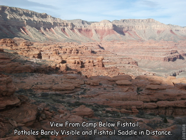
We found a nice place to camp and started looking for water. After about 20 minutes we still hadn’t located any. We had passed some about an hour earlier, and considered sending two people back to pick up a few gallons. But we decided to look a little harder. I finally spotted what I thought were two
potholes in the distance,
on top of a huge mound of Esplanade Sandstone. Ben took off to check it out as I directed him to it with hand gestures. Luckily the potholes were quite large.
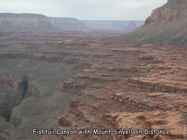
March 31, 2010. We were up early again the next morning. The character of the Esplanade was different now, more sandstone and rock towers, less shale and fewer gullies. And much prettier. There were spectacular views looking down into
Fishtail Canyon.
It took us about 4 hours to reach the top of
Fishtail Saddle.
I had heard of possible remnants of constructed trail, but what I think we found were only very well established game trails. But they helped immensely.
The route down the North side
was longer but not as steep. I wouldn’t hesitate to recommend this route over the saddle. We reached our companions back at camp around 15:00.
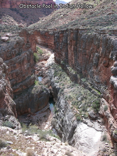
April 1, 2010. This morning we started back to Susan in Kanab Canyon. We took the Redwall bypass again, stopping for a look down into Indian Hollow and the
Obstacle Pool.
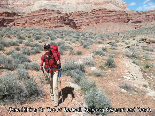
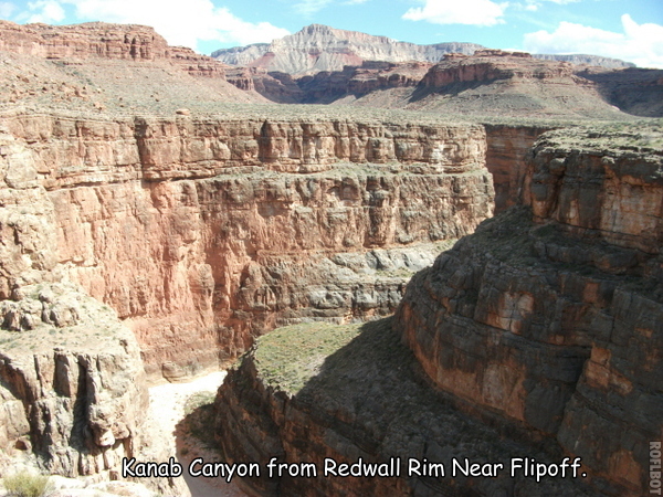
We replenished our water at Kwagunt. I had planned to hike back to Kanab via the Redwall to a point between Flipoff and Chamberlain. It looked easy on the map, and on Google Earth. But some of the others were skeptical. They wanted to know what I knew about the route and where my information came from. After I told them that I didn’t know of anyone ever doing the route (but I’m sure someone has done it), it took a bit of arm twisting to get all to agree to take a chance on the route. It turned out to be a great decision. It was a beautiful walk, with views up to the rim and down into the deep canyon bottoms. The Redwall was mostly flat, smooth, and wide.
Very easy hiking.
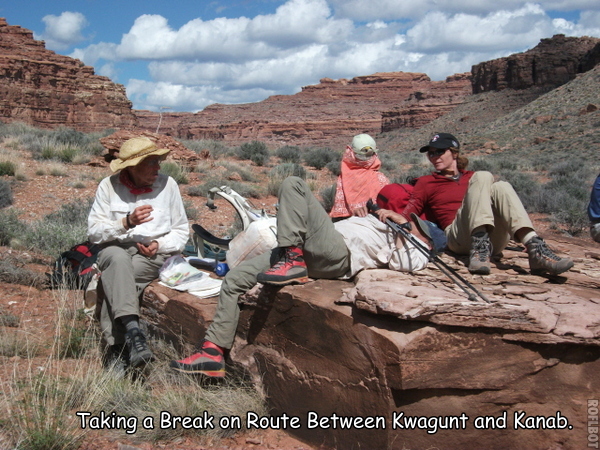
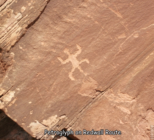
About half way around I spotted a large rock near where we were taking a
break.
I walked over to it and found a nice little
petroglyph.
The Native Americans were everywhere. As we continued hiking, the canyon bottom slowly rose to meet us. We were able to
look down
to the campsite where we left Susan and see that she was no longer there. About a half mile farther we found an easy slope down to the canyon bottom. We found Susan’s cairn and note at the mouth of Flipoff, saying she was going to be camping at the Cottonwood grove. About 45 minutes later we found her. We decided to camp right where she was. Susan's knee was still in bad shape, but maybe a little better.
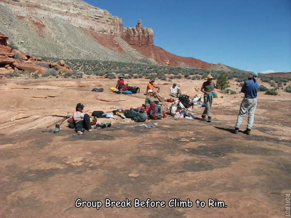
April 2, 2010. We decided to hike to at least the Esplanade today, and depending on how things went, maybe all the way to the rim. We split up as much of Susan's gear as possible. She managed to do pretty well with a light pack. We reached the Esplanade before noon, where we took a long
break.
We decided to continue hiking out that day, reasoning that if Susan wasn’t going to make it, she could return to the Esplanade with one or two others, while the rest of us would hike out to our cars, drive to Kanab, and summon a helicopter. But Susan did remarkably well. We were at our cars by mid afternoon. So we packed up the cars and headed back towards Kanab.
When we got back to our cars, Susan received a cell phone message about the death of a good friend. It was awful for everyone – a very bad ending to an otherwise good hike.
Susan, Jane, Bruce, and Skip drove to Kanab for the night, while Bert, Ben and I drove to Las Vegas. We all had early flights the next morning.
|